MyTopo
Raton New Mexico US Topo Map
Couldn't load pickup availability
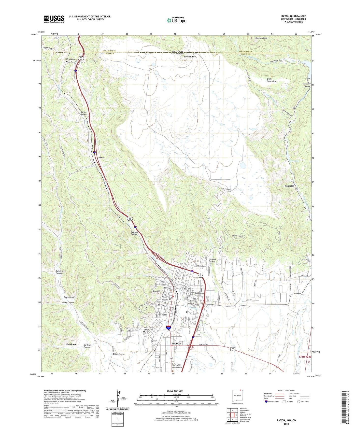
2023 topographic map quadrangle Raton in the states of New Mexico, Colorado. Scale: 1:24000. Based on the newly updated USGS 7.5' US Topo map series, this map is in the following counties: Colfax, Las Animas. The map contains contour data, water features, and other items you are used to seeing on USGS maps, but also has updated roads and other features. This is the next generation of topographic maps. Printed on high-quality waterproof paper with UV fade-resistant inks.
Quads adjacent to this one:
West: Tin Pan Canyon
Northwest: Starkville
North: Fishers Peak
Northeast: Barela
East: Yankee
Southeast: Hunter Mesa
South: Clifton House
Southwest: Red River Peak
This map covers the same area as the classic USGS quad with code o36104h4.
Contains the following named places: Arthur Johnson Memorial Library, Bartlett Mesa, Blossburg, Blossburg Number One Mine, Blossburg Number Three, Blossburg Number Two Mine, Blossburg Post Office, Bobblers Knob, City of Raton, Climax Canyon Park, Climax Mine, Coal Canyon, Colfax County Sheriff's Department, Columbian School, Coxe Canyon, Dillon Canyon, Dona Ana Plaza South, Dutchman Canyon, Fairmont Cemetery, Fred Roth Building, Gardiner, Gardiner Canyon, Gardiner Number One Mine, Gardiner Post Office, Goat Hill, Haven Hotel Historic Site, Investment Block, Joseph Building Historic Site, Kearney School, Kearny Elementary School, Keota, KRTN-AM (Raton), KRTN-FM (Raton), Lake Alice, Lake Alice Dam, Legion Park, Linwood Canyon, Little Horse Mesa, Longfellow Elementary School, Longfellow School, Lynn, Lynn Post Office, Miners Hospital, Mount Calvary Catholic Cemetery, New York and Golden Rule Stores, Northern Colfax County Hospital Library, Palace Hotel, Ragsdale Field, Railroad Canyon, Raton, Raton Catholic School, Raton City Police Department, Raton Downtown Historic District, Raton Fire and Emergency Services, Raton High School, Raton Historical Marker, Raton Middle School, Raton Museum, Raton Pass, Raton Pass Historical Marker, Raton Post Office, Raton Tunnel, Raton Water Works, Raton Weather Station, Ripley Park, Rocky Mountains Historical Marker, Romero Park, Saint Patricks School, Savage Canyon, Second Presbyterian Church, Seeley Canyon, Segerstrom Creek, Seventh Day Adventist, Shuler Theater, Soda Pocket Creek, Sugarite, Sugarite Canyon State Park, Sugarite Number One Mine, Sugarite Number Two Mine, Sugarite Post Office, Van Buskirk, Wootton