MyTopo
Colonias New Mexico US Topo Map
Couldn't load pickup availability
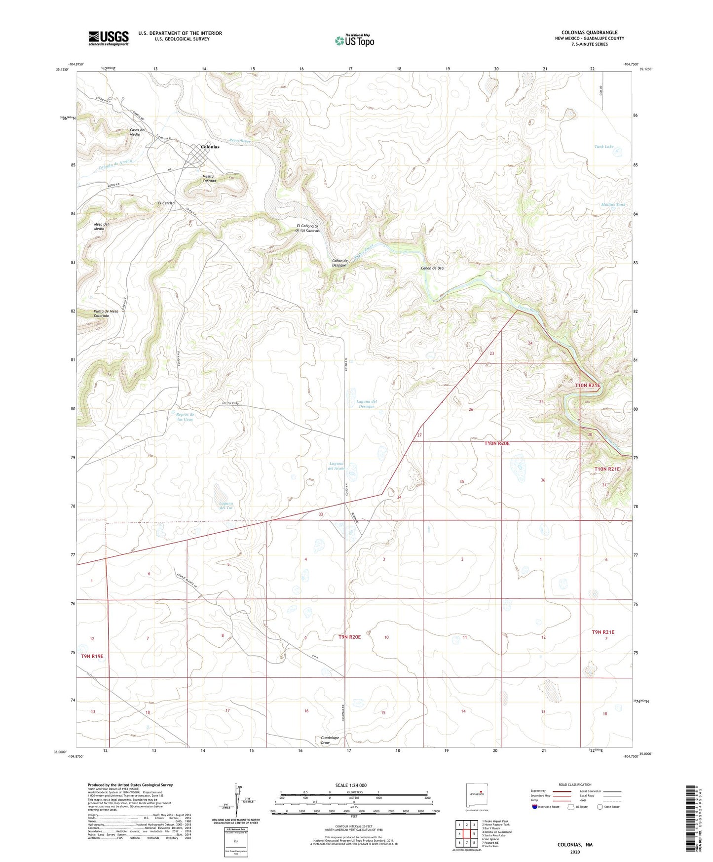
2023 topographic map quadrangle Colonias in the state of New Mexico. Scale: 1:24000. Based on the newly updated USGS 7.5' US Topo map series, this map is in the following counties: Guadalupe. The map contains contour data, water features, and other items you are used to seeing on USGS maps, but also has updated roads and other features. This is the next generation of topographic maps. Printed on high-quality waterproof paper with UV fade-resistant inks.
Quads adjacent to this one:
West: Mesita De Guadalupe
Northwest: Pedro Miguel Peak
North: Horse Pasture Tank
Northeast: Bar Y Ranch
East: Santa Rosa Lake
Southeast: Santa Rosa
South: Pastura NE
Southwest: San Ignacio
This map covers the same area as the classic USGS quad with code o35104a7.
Contains the following named places: Canada de Abajo, Canada de Arriba, Canon de Desaque, Canon de Uta, Capps Well, Casas del Medio, Colonias, Colonias Census Designated Place, Colonias de San Jose Historic District, Colonias Post Office, El Canoncito de las Canovas, El Cerrito, La Placita de Abajo Historic District, Laguna del Arabe, Laguna del Desaque, Laguna del Tul, Laguna Seca, Manuel Ulibarri Ranch, Margarito Ulibarri Ranch, Mesita Cortada, Mullins Tank, P Ulibarri Ranch, Punta de Mesa Colorado, Repres de las Uvas, Rincon Entranoso, Rock Tank, Sanchez Well, Tank Lake, West Well