
MyTopo
Conejo Creek East New Mexico US Topo Map
Couldn't load pickup availability
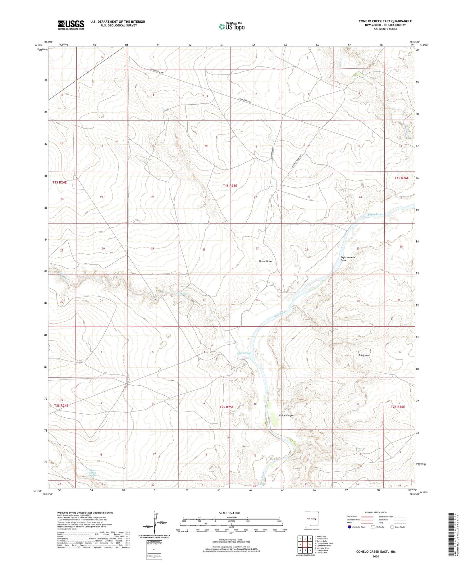
2020 topographic map quadrangle Conejo Creek East in the state of New Mexico. Scale: 1:24000. Based on the newly updated USGS 7.5' US Topo map series, this map is in the following counties: De Baca. The map contains contour data, water features, and other items you are used to seeing on USGS maps, but also has updated roads and other features. This is the next generation of topographic maps. Printed on high-quality waterproof paper with UV fade-resistant inks.
Quads adjacent to this one:
West: Conejo Creek West
Northwest: West Camp
North: Alamo Ranch
Northeast: Bonner Lake
East: Eighteenmile Hill
Southeast: Cooley Lake
South: La Espia Peak
Southwest: Lovelady Draw
Contains the following named places: 10011 Water Well, 10015 Water Well, 10020 Water Well, 10021 Water Well, 10022 Water Well, 10023 Water Well, 10024 Water Well, 10025 Water Well, 10026 Water Well, 10027 Water Well, 10028 Water Well, 10029 Water Well, 10782 Water Well, Alamo Draw, Baldy Mountain, Blanco Spring Number 2, Conejo Creek, Crane Canyon, Eighteenmile Draw, Horse Pasture Well, Rattlesnake Windmill, Shaw Spring, Trigg Ranch River Camp


