MyTopo
Cooley Lake New Mexico US Topo Map
Couldn't load pickup availability
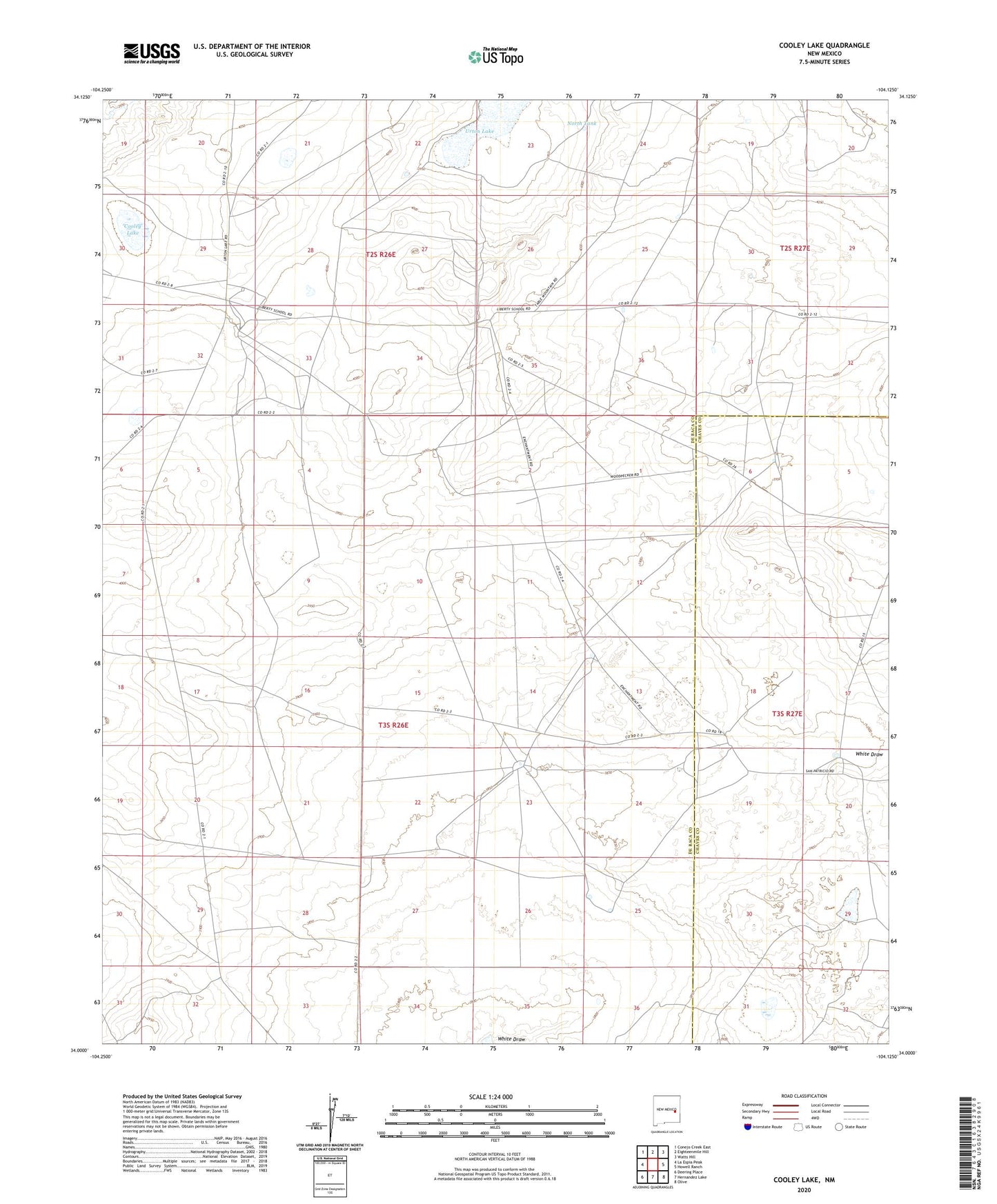
2023 topographic map quadrangle Cooley Lake in the state of New Mexico. Scale: 1:24000. Based on the newly updated USGS 7.5' US Topo map series, this map is in the following counties: De Baca, Chaves. The map contains contour data, water features, and other items you are used to seeing on USGS maps, but also has updated roads and other features. This is the next generation of topographic maps. Printed on high-quality waterproof paper with UV fade-resistant inks.
Quads adjacent to this one:
West: La Espia Peak
Northwest: Conejo Creek East
North: Eighteenmile Hill
Northeast: Watts Hill
East: Howell Ranch
Southeast: Olive
South: Hernandez Lake
Southwest: Deering Place
This map covers the same area as the classic USGS quad with code o34104a2.
Contains the following named places: 10711 Water Well, 10712 Water Well, 10713 Water Well, 10714 Water Well, 10715 Water Well, 10716 Water Well, 10718 Water Well, 10719 Water Well, 10720 Water Well, 10785 Water Well, Cooley Lake, Good Ranch, Heifer Windmill, Howell Windmill, McDowell Ranch, Middle Spy Windmill, North Spy Windmill, North Tank, Sea Camp, Urton Lake, West Windmills, White Draw