MyTopo
Lovelady Draw New Mexico US Topo Map
Couldn't load pickup availability
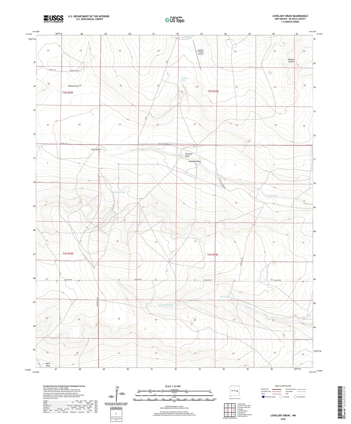
2023 topographic map quadrangle Lovelady Draw in the state of New Mexico. Scale: 1:24000. Based on the newly updated USGS 7.5' US Topo map series, this map is in the following counties: De Baca. The map contains contour data, water features, and other items you are used to seeing on USGS maps, but also has updated roads and other features. This is the next generation of topographic maps. Printed on high-quality waterproof paper with UV fade-resistant inks.
Quads adjacent to this one:
West: Dunlap
Northwest: Dunlap NE
North: Conejo Creek West
Northeast: Conejo Creek East
East: La Espia Peak
Southeast: Deering Place
South: Swallow Nest Canyon
Southwest: Dunlap Sill
This map covers the same area as the classic USGS quad with code o34104a4.
Contains the following named places: Baker Ranch, Cottonwood Well, Double V Ranch Airport, Duke Windmill, Galloway Tank, Gibbons Ranch, Gillespie Draw, Hart Draw, Lightfoot Windmill, Lovelady Draw, Lovelady Spring, Lovelady Springs, Pursley Windmill, Shirley Ranch, Short Tank, Simmons Windmill, Small Windmill, Whites Draw