
MyTopo
Cooper Canyon New Mexico US Topo Map
Couldn't load pickup availability
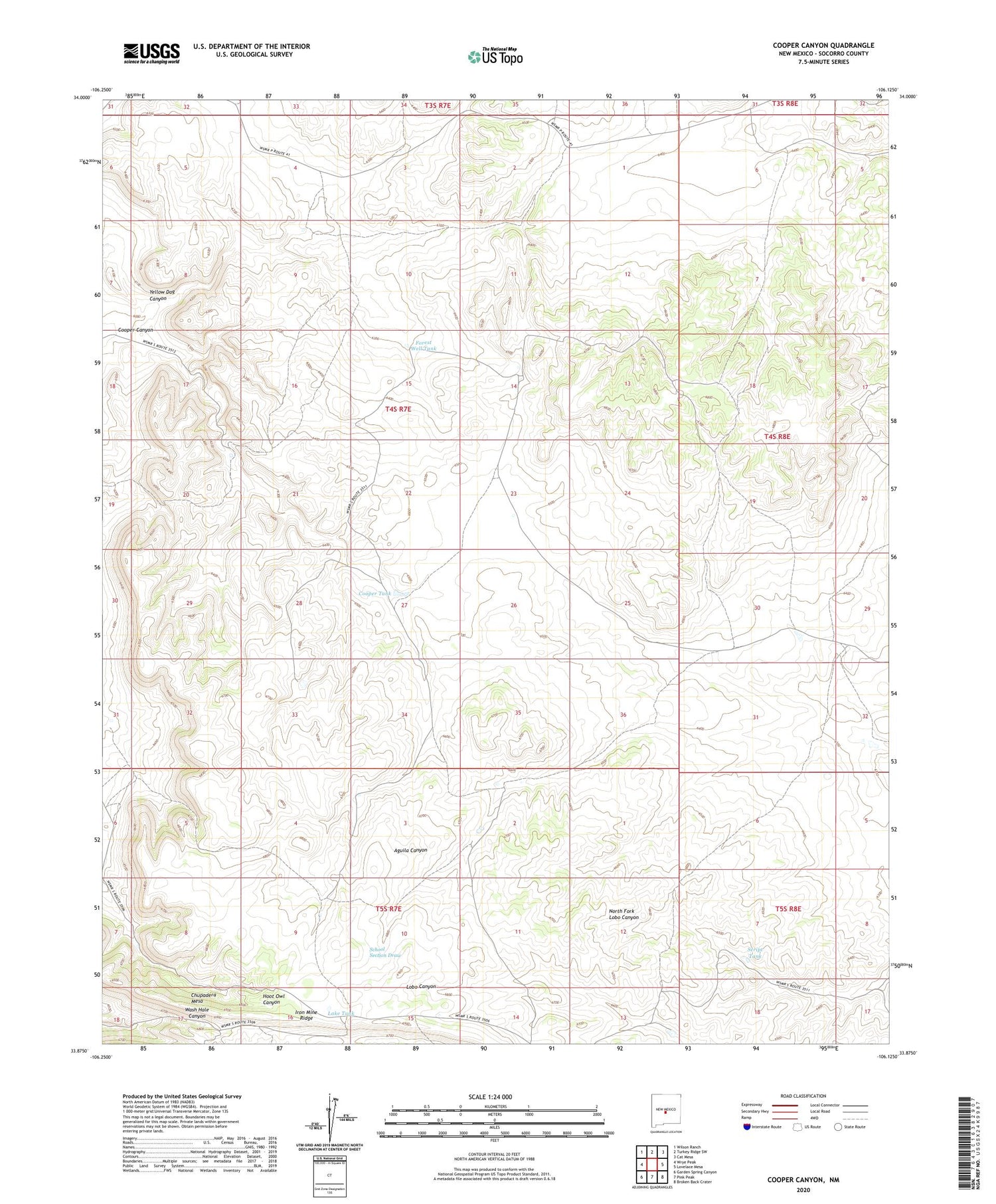
2023 topographic map quadrangle Cooper Canyon in the state of New Mexico. Scale: 1:24000. Based on the newly updated USGS 7.5' US Topo map series, this map is in the following counties: Socorro. The map contains contour data, water features, and other items you are used to seeing on USGS maps, but also has updated roads and other features. This is the next generation of topographic maps. Printed on high-quality waterproof paper with UV fade-resistant inks.
Quads adjacent to this one:
West: Wrye Peak
Northwest: Wilson Ranch
North: Turkey Ridge SW
Northeast: Cat Mesa
East: Lovelace Mesa
Southeast: Broken Back Crater
South: Pink Peak
Southwest: Garden Spring Canyon
This map covers the same area as the classic USGS quad with code o33106h2.
Contains the following named places: Chupadera Mesa, Cooper Canyon, Cooper Tank, Forest Well, Forest Well Tank, Iron Mine Ridge, Kiloore Ranch, Lake Tank, Lobo Tank, Malina Windmill, Mesa Tank, Mesa Windmill, New Forest Windmill, Ratliff Ranch, School Section Tank, School Section Windmill, Script Tank, Yellow Dog Canyon


