MyTopo
Lovelace Mesa New Mexico US Topo Map
Couldn't load pickup availability
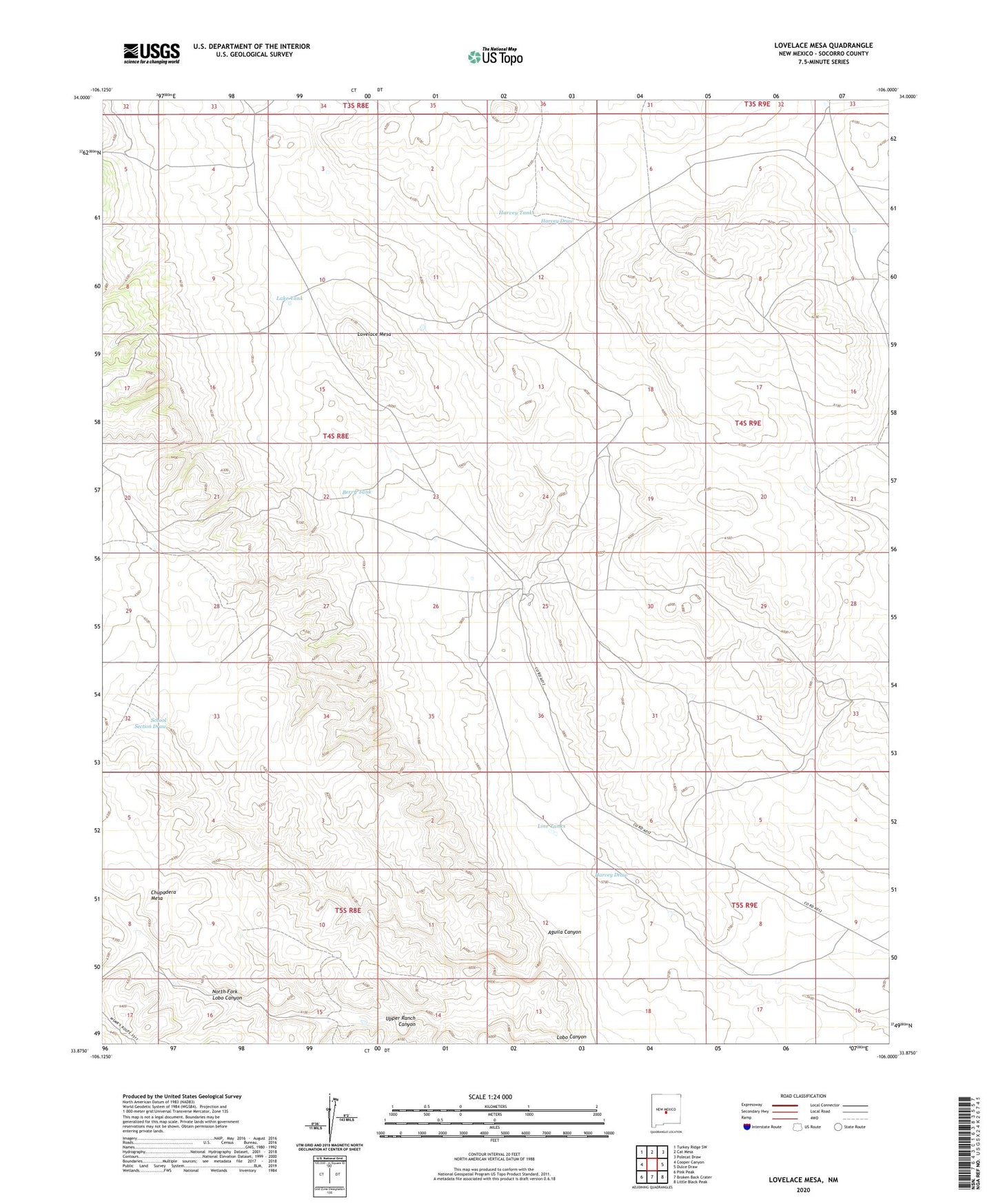
2023 topographic map quadrangle Lovelace Mesa in the state of New Mexico. Scale: 1:24000. Based on the newly updated USGS 7.5' US Topo map series, this map is in the following counties: Socorro. The map contains contour data, water features, and other items you are used to seeing on USGS maps, but also has updated roads and other features. This is the next generation of topographic maps. Printed on high-quality waterproof paper with UV fade-resistant inks.
Quads adjacent to this one:
West: Cooper Canyon
Northwest: Turkey Ridge SW
North: Cat Mesa
Northeast: Polecat Draw
East: Dulce Draw
Southeast: Little Black Peak
South: Broken Back Crater
Southwest: Pink Peak
This map covers the same area as the classic USGS quad with code o33106h1.
Contains the following named places: Aguila Canyon, Aguila Tank, Antelope Tank, Berry Tank, Bull Trap Tank, Dawson Tank, Frog Tank, Gyp Tank, Harvey Ranch, Harvey Tank, Lake Tank, Line Tanks, Lovelace Mesa, McDaniel Ranch, North Fork Lobo Canyon, North Windmill, Poodle Tank, Powder River Tank, School Section Draw, Scotts Tanks, South Pasture Tanks, South Tank, Upper Ranch