MyTopo
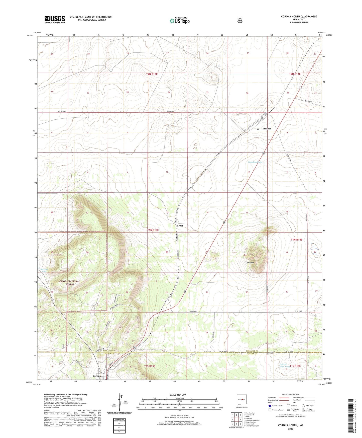
Corona North New Mexico US Topo Map
Couldn't load pickup availability
Also explore the Corona North Forest Service Topo of this same quad for updated USFS data
2023 topographic map quadrangle Corona North in the state of New Mexico. Scale: 1:24000. Based on the newly updated USGS 7.5' US Topo map series, this map is in the following counties: Torrance, Lincoln. The map contains contour data, water features, and other items you are used to seeing on USGS maps, but also has updated roads and other features. This is the next generation of topographic maps. Printed on high-quality waterproof paper with UV fade-resistant inks.
Quads adjacent to this one:
West: Cedarvale
Northwest: Pino Mountain
North: Cedarvale NE
Northeast: Duran
East: Camaleon Draw West
Southeast: Gallo Spring Canyon
South: Corona South
Southwest: Rough Mountain
Contains the following named places: Bagley Ranch, Brunson Ranch, Camaleon, Corona, Corona Elementary School, Corona High School, Corona Post Office, Corona Weather Station, First Baptist Church, Lee Tank, North Simpson Tank, Shartzer Tank, Torrance, Torrance Post Office, Varney, Village of Corona