MyTopo
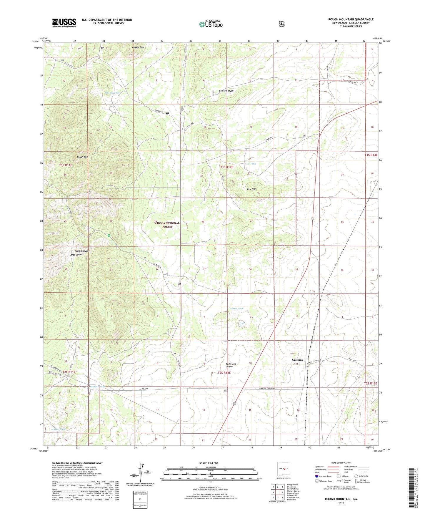
Rough Mountain New Mexico US Topo Map
Couldn't load pickup availability
Also explore the Rough Mountain Forest Service Topo of this same quad for updated USFS data
2023 topographic map quadrangle Rough Mountain in the state of New Mexico. Scale: 1:24000. Based on the newly updated USGS 7.5' US Topo map series, this map is in the following counties: Lincoln. The map contains contour data, water features, and other items you are used to seeing on USGS maps, but also has updated roads and other features. This is the next generation of topographic maps. Printed on high-quality waterproof paper with UV fade-resistant inks.
Quads adjacent to this one:
West: Pajaro Canyon
Northwest: Progresso SE
North: Cedarvale
Northeast: Corona North
East: Corona South
Southeast: Pelon Hill
South: Tecolote Peak
Southwest: Claunch SE
This map covers the same area as the classic USGS quad with code o34105b6.
Contains the following named places: All American Prospect, Bagley Ranch, Bates Tank, Bates Trick Tank, Big Ben Prospect, Big Lake, Bookout Tank, Bottleneck, Bottleneck Prospect, Bryan, Bryan Ranch, Buckhorn, Congress Prospect, Conqueror Mine, Conqueror Number Four Prospect, Conqueror Number Nine, Corona, Corona Queen Mine, Cougar Tank, Deadwood, Eagle Nest, Eagle Nest Prospect, El Paso Wells, Erramouspe Ranch, Eureka Prospect, Gallinas, Gallinas Rare Earth Deposits, Gallinas Weather Station, Granans Ranch, Helen S, Herring Ranch, Hilltop, Hoosier Girl Prospect, Iron Chief, Jenkins Tank, Last Chance, Little Wonder, Old Hickory Mine, Pine Hill, Pine Hill Trick Tank, Pine Tank, Porter Tank, Red Cliff, Red Cloud Mine, Red Cloud Trick Tank, Rough Mountain, South Mountain Trick Tank, South Saddle Trick Tank, Stroope Tank, Stroope Well, Summit Prospect, T S Tank