MyTopo
Cow Springs Mountain New Mexico US Topo Map
Couldn't load pickup availability
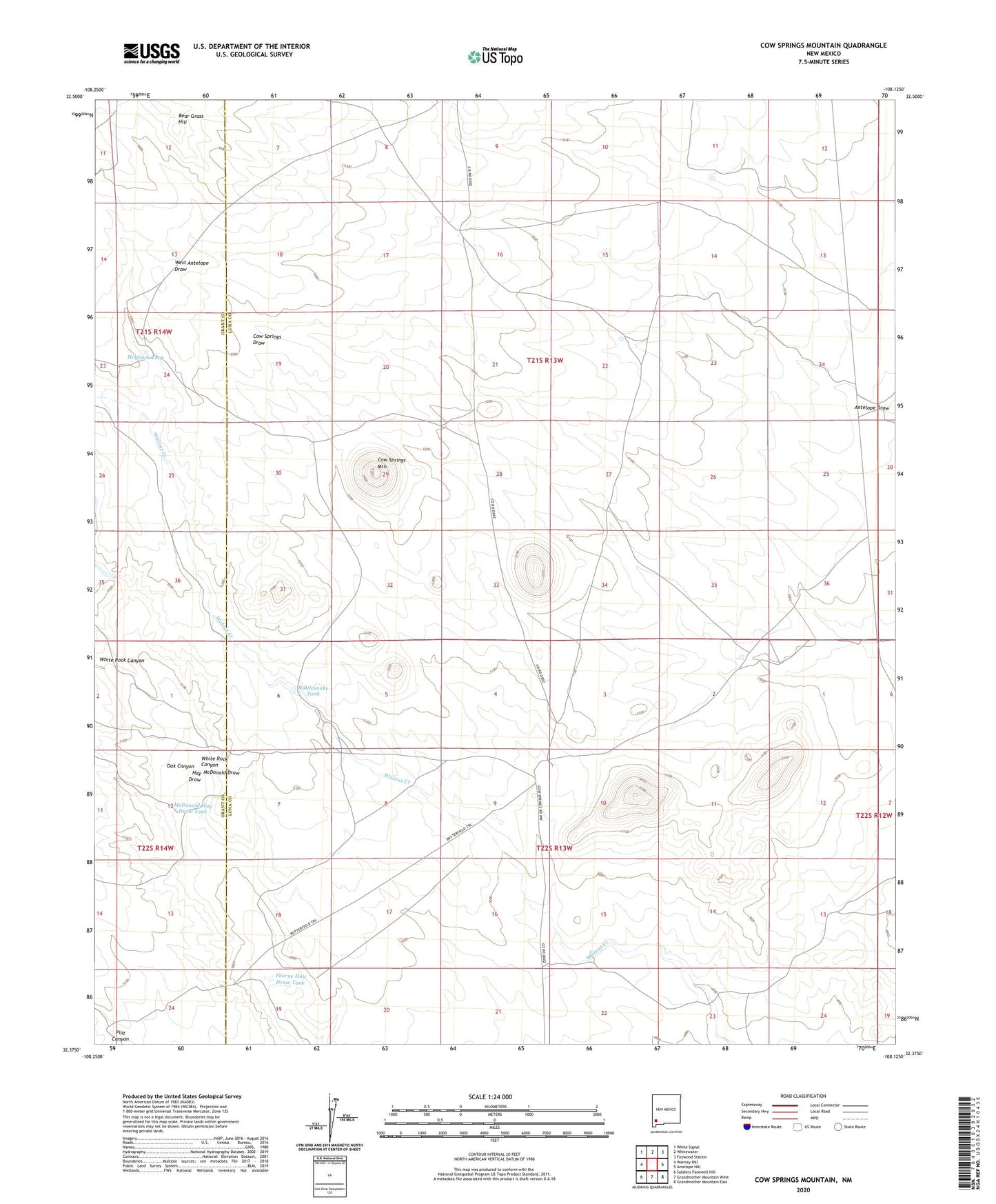
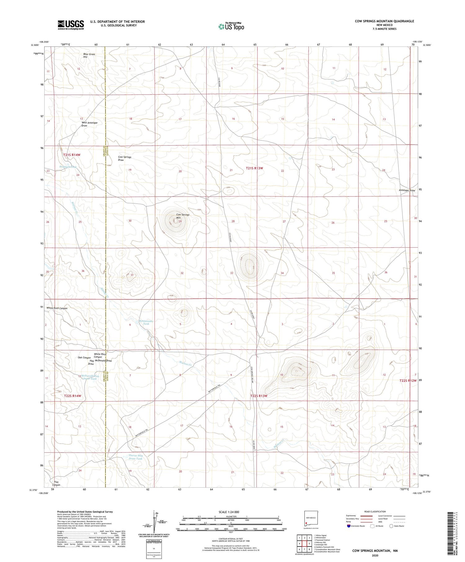
2020 topographic map quadrangle Cow Springs Mountain in the state of New Mexico. Scale: 1:24000. Based on the newly updated USGS 7.5' US Topo map series, this map is in the following counties: Luna, Grant. The map contains contour data, water features, and other items you are used to seeing on USGS maps, but also has updated roads and other features. This is the next generation of topographic maps. Printed on high-quality waterproof paper with UV fade-resistant inks.
Quads adjacent to this one:
West: Werney Hill
Northwest: White Signal
North: Whitewater
Northeast: Faywood Station
East: Antelope Hill
Southeast: Grandmother Mountain East
South: Grandmother Mountain West
Southwest: Soldiers Farewell Hill
Contains the following named places: 01264 Water Well, 01265 Water Well, 01338 Water Well, 01339 Water Well, Bear Grass Hill, Childress Water Well, Childress Windmill, Cow Springs Mountain, Cow Springs Ranch, Cow Springs Windmill, Dave Smith Windmill, Deep Well, Hay Meadow Windmill, Hogback Tank, McDonald Draw, McDonald Hay Draw Tank, New Well, Number 1263 Water Well, Oak Canyon, Rattlesnake Tank, Round Top Windmill, Thorne Hay Draw Tank, Trinity Ranch, Trouble Windmill, White Rock Canyon