MyTopo
Faywood Station New Mexico US Topo Map
Couldn't load pickup availability
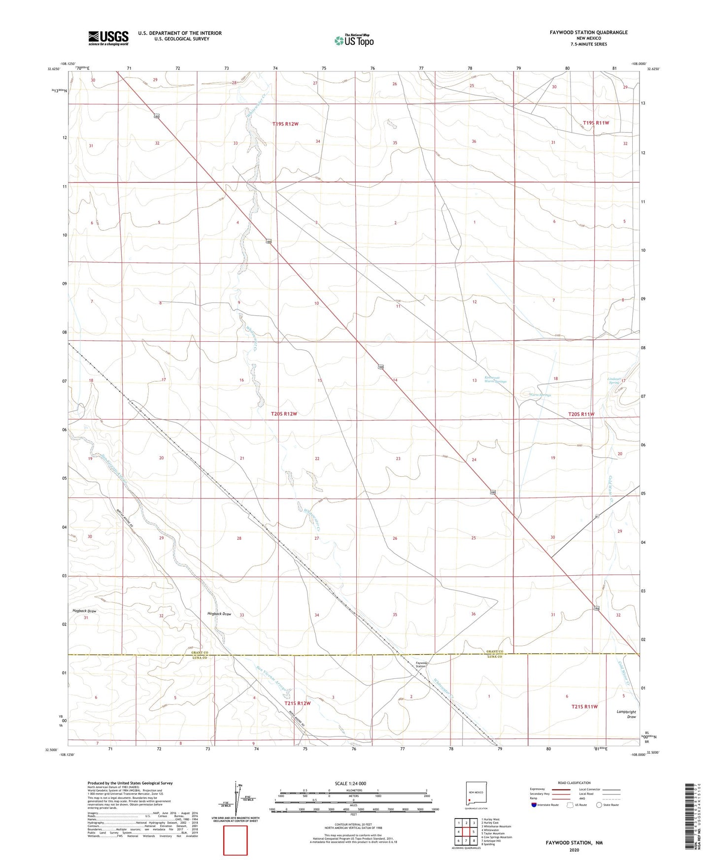
2023 topographic map quadrangle Faywood Station in the state of New Mexico. Scale: 1:24000. Based on the newly updated USGS 7.5' US Topo map series, this map is in the following counties: Grant, Luna. The map contains contour data, water features, and other items you are used to seeing on USGS maps, but also has updated roads and other features. This is the next generation of topographic maps. Printed on high-quality waterproof paper with UV fade-resistant inks.
Quads adjacent to this one:
West: Whitewater
Northwest: Hurley West
North: Hurley East
Northeast: Whitehorse Mountain
East: Taylor Mountain
Southeast: Spalding
South: Antelope Hill
Southwest: Cow Springs Mountain
This map covers the same area as the classic USGS quad with code o32108e1.
Contains the following named places: 00658 Water Well, 00866 Water Well, 00868 Water Well, 00870 Water Well, 00908 Water Well, 00909 Water Well, 00910 Water Well, 00912 Water Well, 00914 Water Well, 00916 Water Well, 00918 Water Well, 00921 Water Well, 01293 Water Well, 01311 Water Well, 01312 Water Well, 01313 Water Well, 01314 Water Well, 01315 Water Well, 01316 Water Well, 01317 Water Well, 01318 Water Well, 01322 Water Well, 05036 Water Well, 10042 Water Well, 10043 Water Well, 2-C Cattle Company, 88043, Cold Spring 2 Water Well, Cold Water Creek, Faywood, Faywood Post Office, Faywood Station, G 854 Water Well, G 893 Water Well, Hogback Draw, Kennecott Warm Springs, Lindauer Spring, Warm Springs