
MyTopo
Grandmother Mountain East New Mexico US Topo Map
Couldn't load pickup availability
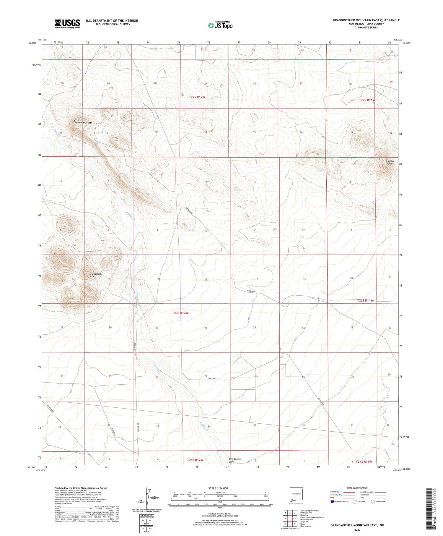
2023 topographic map quadrangle Grandmother Mountain East in the state of New Mexico. Scale: 1:24000. Based on the newly updated USGS 7.5' US Topo map series, this map is in the following counties: Luna. The map contains contour data, water features, and other items you are used to seeing on USGS maps, but also has updated roads and other features. This is the next generation of topographic maps. Printed on high-quality waterproof paper with UV fade-resistant inks.
Quads adjacent to this one:
West: Grandmother Mountain West
Northwest: Cow Springs Mountain
North: Antelope Hill
Northeast: Spalding
East: Williams Ranch
Southeast: Red Mountain
South: Gage
Southwest: Gage NW
This map covers the same area as the classic USGS quad with code o32108c1.
Contains the following named places: 01261 Water Well, 01366 Water Well, 01367 Water Well, 01370 Water Well, 01388 Water Well, 06037 Water Well, 06092 Water Well, Benedict Ranch, Clabber Top Hill, Davis Ranch, Dunn Windmill, Gage Windmill, Little Grandmother Mountain, New Windmill, North Windmill, Number 1255 Water Well, Rimrock Windmill, Stevens Windmill


