MyTopo
Antelope Hill New Mexico US Topo Map
Couldn't load pickup availability
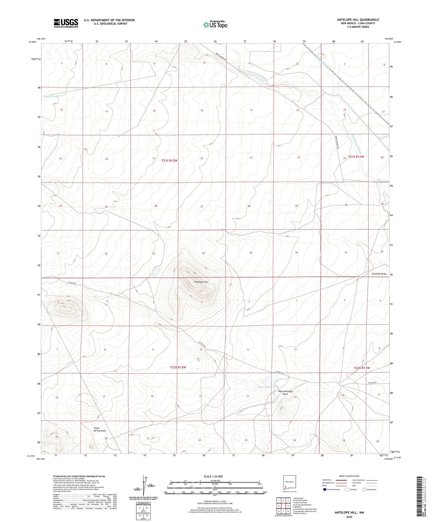
2023 topographic map quadrangle Antelope Hill in the state of New Mexico. Scale: 1:24000. Based on the newly updated USGS 7.5' US Topo map series, this map is in the following counties: Luna. The map contains contour data, water features, and other items you are used to seeing on USGS maps, but also has updated roads and other features. This is the next generation of topographic maps. Printed on high-quality waterproof paper with UV fade-resistant inks.
Quads adjacent to this one:
West: Cow Springs Mountain
Northwest: Whitewater
North: Faywood Station
Northeast: Taylor Mountain
East: Spalding
Southeast: Williams Ranch
South: Grandmother Mountain East
Southwest: Grandmother Mountain West
This map covers the same area as the classic USGS quad with code o32108d1.
Contains the following named places: 01250 Water Well, 01257 Water Well, 01258 Water Well, 01259 Water Well, 01267 Water Well, 01301 Water Well, 01302 Water Well, 01307 Water Well, 01319 Water Well, 01320 Water Well, 01321 Water Well, 01323 Water Well, 01324 Water Well, 01325 Water Well, 01326 Water Well, 01327 Water Well, 01328 Water Well, 01329 Water Well, 01330 Water Well, 01331 Water Well, 01333 Water Well, 01334 Water Well, 01335 Water Well, 01336 Water Well, 01471 Water Well, 06038 Water Well, 1260 Water Well, Antelope Hill, Antelope Windmill, Bar O Ranch, Butterfield Windmill, Chicken Windmill, Criswell Tank, Criswell Windmill, Homestead Windmill, Jones Spring Ranch, Munson Windmill, Upton Tank, West Antelope Draw, Whitewater Creek, Yates Windmill