MyTopo
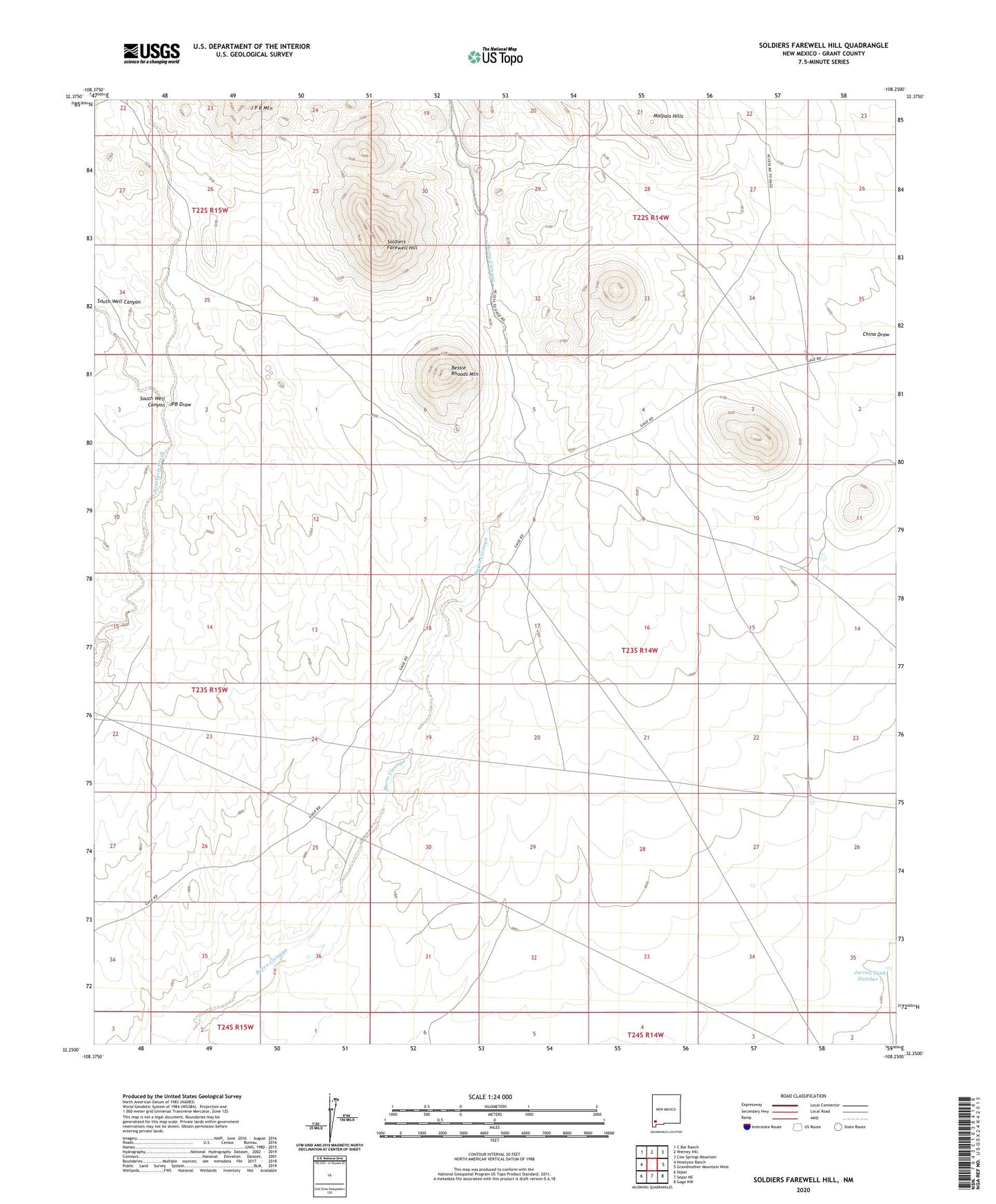
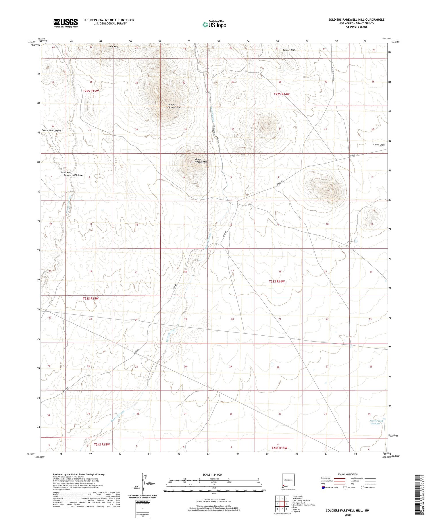
Soldiers Farewell Hill New Mexico US Topo Map
Couldn't load pickup availability
2023 topographic map quadrangle Soldiers Farewell Hill in the state of New Mexico. Scale: 1:24000. Based on the newly updated USGS 7.5' US Topo map series, this map is in the following counties: Grant. The map contains contour data, water features, and other items you are used to seeing on USGS maps, but also has updated roads and other features. This is the next generation of topographic maps. Printed on high-quality waterproof paper with UV fade-resistant inks.
Quads adjacent to this one:
West: Ninetysix Ranch
Northwest: C Bar Ranch
North: Werney Hill
Northeast: Cow Springs Mountain
East: Grandmother Mountain West
Southeast: Gage NW
South: Separ NE
Southwest: Separ
This map covers the same area as the classic USGS quad with code o32108c3.
Contains the following named places: Barrow Windmill, Bessie Rhoads Mountain, Big Box Windmill, Butterfield Trail, Hurley Division, J P B Water Well, Japanese Ranch Deposit, Jarrell Ranch, Jarrell Tank Number 1, JPB Draw, JPB Windmill, Little Box Windmill, Soldiers Farewell Hill, Soldiers Farewell Stage Station, South Well Canyon, Thorne Ranch