MyTopo
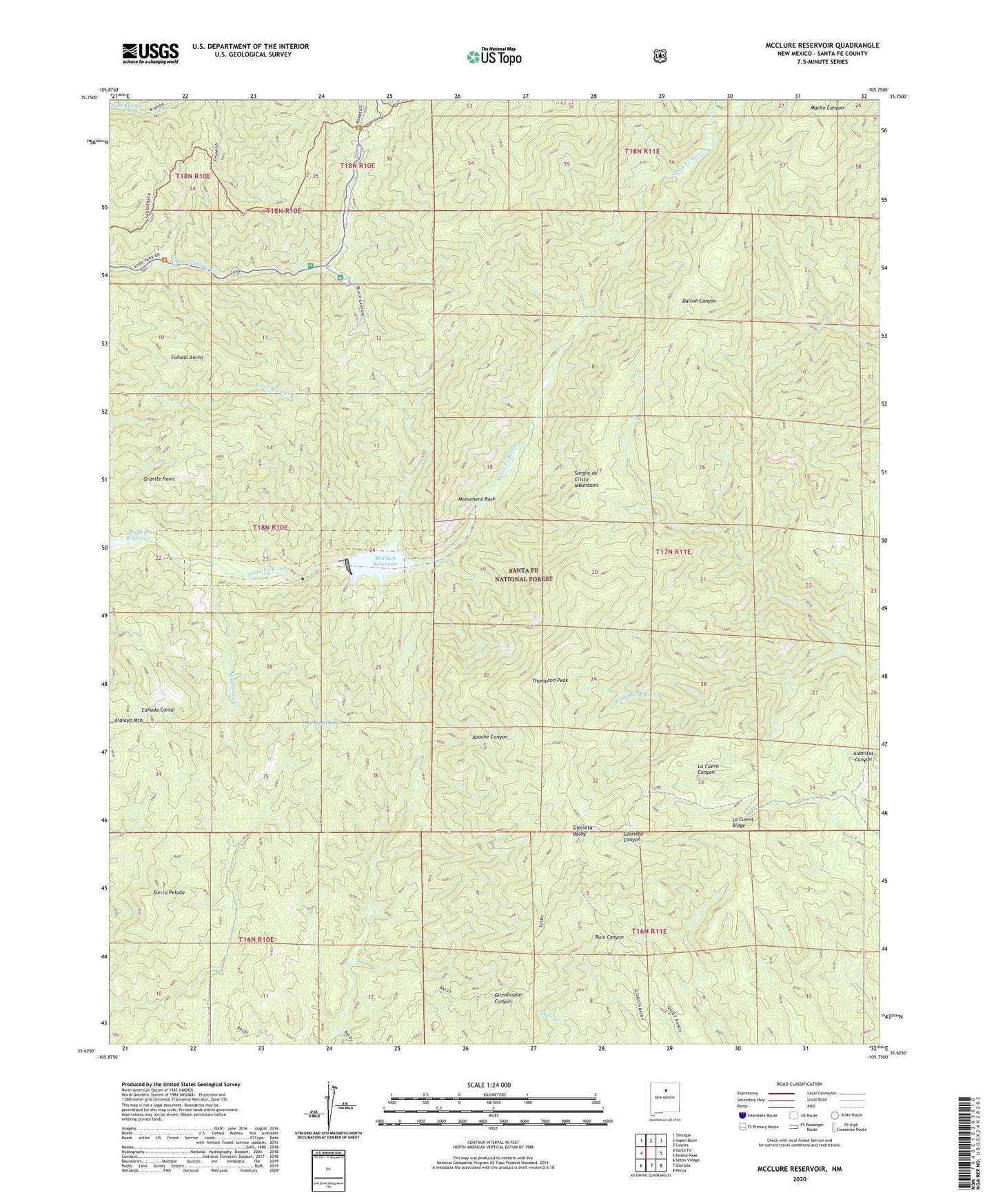
McClure Reservoir New Mexico US Topo Map
Couldn't load pickup availability
Also explore the McClure Reservoir Forest Service Topo of this same quad for updated USFS data
2023 topographic map quadrangle McClure Reservoir in the state of New Mexico. Scale: 1:24000. Based on the newly updated USGS 7.5' US Topo map series, this map is in the following counties: Santa Fe. The map contains contour data, water features, and other items you are used to seeing on USGS maps, but also has updated roads and other features. This is the next generation of topographic maps. Printed on high-quality waterproof paper with UV fade-resistant inks.
Quads adjacent to this one:
West: Santa Fe
Northwest: Tesuque
North: Aspen Basin
Northeast: Cowles
East: Rosilla Peak
Southeast: Pecos
South: Glorieta
Southwest: Seton Village
This map covers the same area as the classic USGS quad with code o35105f7.
Contains the following named places: Agua Sarca Creek, Atalaya Trail, Black Canyon Forest Camp, Chamiza Trail, Evergreen Lodge, Glorieta Baldy, Glorieta Baldy Lookout Tower Historic Site, Glorieta Picnic Area, Granite Point, Granite Point Reservoir, Hyde Memorial State Park, La Cueva Ridge, Little Tesuque Camp, McClure Dam, McClure Reservoir, Monument Rock, Santa Fe Municipal Watershed, Santiago Ramirez Grant, Sierra Pelada, Thompson Peak, Thompson Peak Trail, Wild Horse Creek, ZIP Code: 87501