MyTopo
Coyote Peak New Mexico US Topo Map
Couldn't load pickup availability
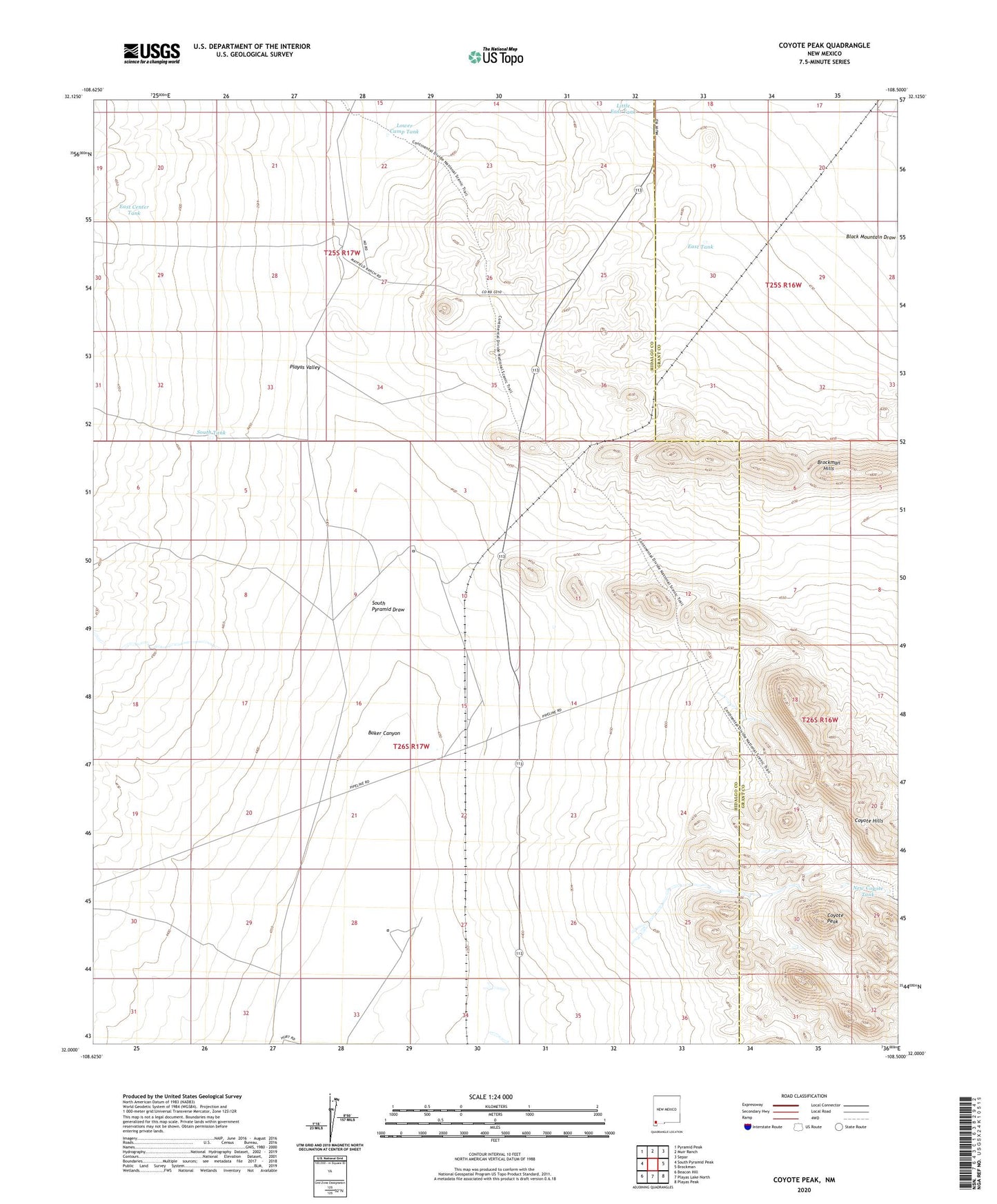
2020 topographic map quadrangle Coyote Peak in the state of New Mexico. Scale: 1:24000. Based on the newly updated USGS 7.5' US Topo map series, this map is in the following counties: Hidalgo, Grant. The map contains contour data, water features, and other items you are used to seeing on USGS maps, but also has updated roads and other features. This is the next generation of topographic maps. Printed on high-quality waterproof paper with UV fade-resistant inks.
Quads adjacent to this one:
West: South Pyramid Peak
Northwest: Pyramid Peak
North: Muir Ranch
Northeast: Separ
East: Brockman
Southeast: Playas Peak
South: Playas Lake North
Southwest: Beacon Hill
Contains the following named places: Baker Canyon, Baker Wells, Bertoglio-Merrill Ranch, Brockman Hills, Brockman Mine, Cherrys Mines, Coyote Peak, Diamond A Ranch, East Center Tank, East Tank, Forced Issue Mine, Hawkins Kelly and Butterworth Mine, Little East Tank, Lone Hill Windmill, Lower Camp Tank, New Coyote Tank, Oneil Water Well, O'Neil Well, South Pyramid Draw, South Tank, Waldo Mine