
MyTopo
Separ New Mexico US Topo Map
Couldn't load pickup availability
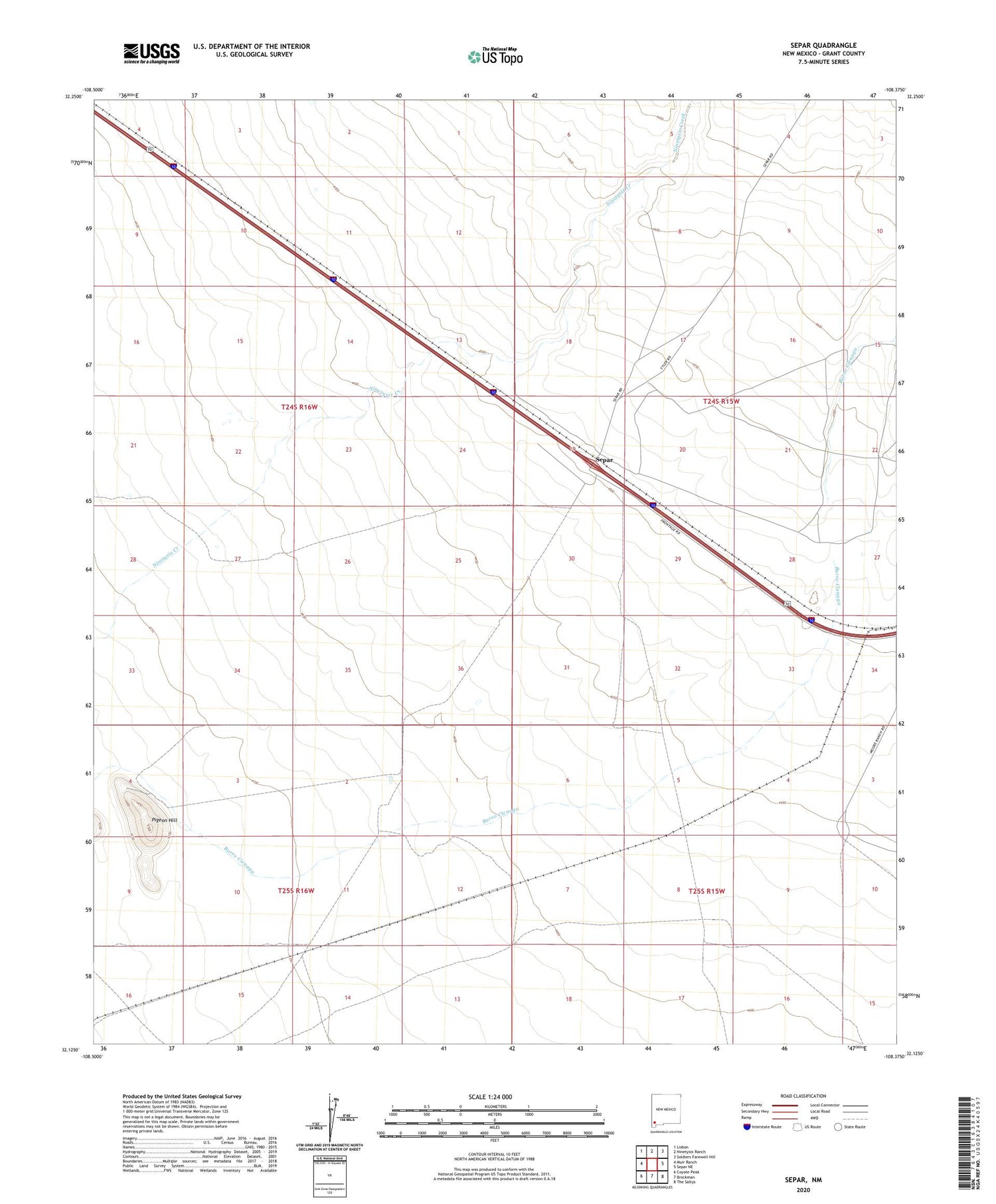
2023 topographic map quadrangle Separ in the state of New Mexico. Scale: 1:24000. Based on the newly updated USGS 7.5' US Topo map series, this map is in the following counties: Grant. The map contains contour data, water features, and other items you are used to seeing on USGS maps, but also has updated roads and other features. This is the next generation of topographic maps. Printed on high-quality waterproof paper with UV fade-resistant inks.
Quads adjacent to this one:
West: Muir Ranch
Northwest: Lisbon
North: Ninetysix Ranch
Northeast: Soldiers Farewell Hill
East: Separ NE
Southeast: The Saltys
South: Brockman
Southwest: Coyote Peak
This map covers the same area as the classic USGS quad with code o32108b4.
Contains the following named places: 10166 Water Well, 10197 Water Well, Armstrong Well, Cox Ranch, Glaze Windmill, Kelly Well, May Well, Moore Ranch, Phillips Well, Pigeon Hill, Separ, Separ Post Office, Separ Ranch, South Cox Well


