MyTopo
Playas Peak New Mexico US Topo Map
Couldn't load pickup availability
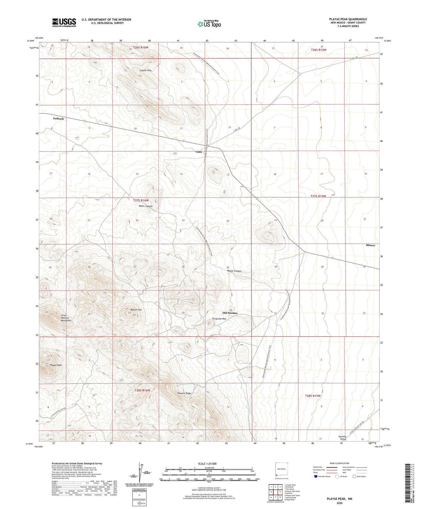
2023 topographic map quadrangle Playas Peak in the state of New Mexico. Scale: 1:24000. Based on the newly updated USGS 7.5' US Topo map series, this map is in the following counties: Grant. The map contains contour data, water features, and other items you are used to seeing on USGS maps, but also has updated roads and other features. This is the next generation of topographic maps. Printed on high-quality waterproof paper with UV fade-resistant inks.
Quads adjacent to this one:
West: Playas Lake North
Northwest: Coyote Peak
North: Brockman
Northeast: The Saltys
East: Hachita
Southeast: Doyle Peak
South: Hachita Peak
Southwest: Playas Lake South
This map covers the same area as the classic USGS quad with code o31108h4.
Contains the following named places: Baylor Canyon, Beacon Hill, Hornet Mine, Howard Shaft, Howells Ridge, King 400 Mine, Minero, Miss Pickle Tunnel, Old Hachita, Old Hachita Mine, Playas Peak, Pothook, Ringbone Ranch, Silver Bell, Skunk Ranch, Turquoise Mountain, Vista, Water Canyon