MyTopo
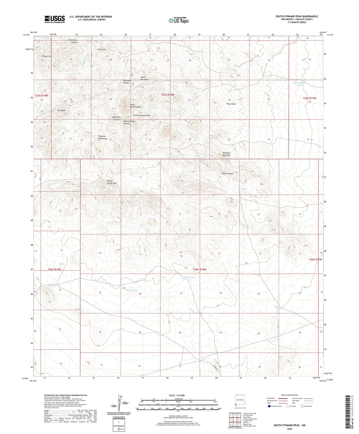
South Pyramid Peak New Mexico US Topo Map
Couldn't load pickup availability
2023 topographic map quadrangle South Pyramid Peak in the state of New Mexico. Scale: 1:24000. Based on the newly updated USGS 7.5' US Topo map series, this map is in the following counties: Hidalgo. The map contains contour data, water features, and other items you are used to seeing on USGS maps, but also has updated roads and other features. This is the next generation of topographic maps. Printed on high-quality waterproof paper with UV fade-resistant inks.
Quads adjacent to this one:
West: Table Top Mountain
Northwest: Swallow Fork Peak
North: Pyramid Peak
Northeast: Muir Ranch
East: Coyote Peak
Southeast: Playas Lake North
South: Beacon Hill
Southwest: Animas
This map covers the same area as the classic USGS quad with code o32108a6.
Contains the following named places: Bigote Tank, China Pond, Cinco Well, Double Tanks, Elephant Back Hill, Hidden Well, Hightower Well, Hill Well, Ira Tank, Kirk Peak, Middle Tank, New Well, Piedra Wells, Pinkey Wright Mountain, Pinkey Wright Well, Rainbow Well, Rattler Well, Russel Hills, South Pyramid Peak, West Baker Well, West Center Tank