MyTopo
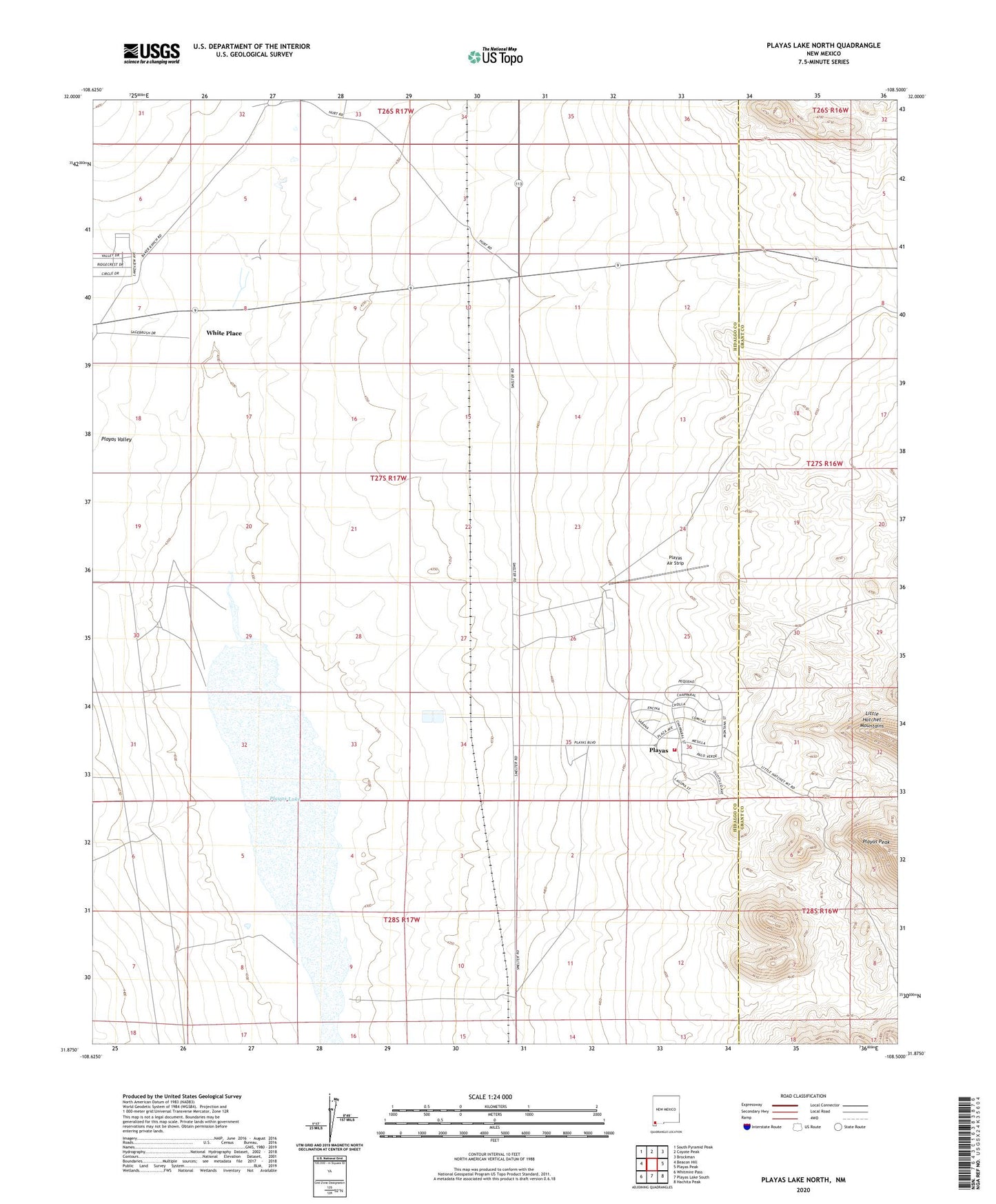
Playas Lake North New Mexico US Topo Map
Couldn't load pickup availability
2023 topographic map quadrangle Playas Lake North in the state of New Mexico. Scale: 1:24000. Based on the newly updated USGS 7.5' US Topo map series, this map is in the following counties: Hidalgo, Grant. The map contains contour data, water features, and other items you are used to seeing on USGS maps, but also has updated roads and other features. This is the next generation of topographic maps. Printed on high-quality waterproof paper with UV fade-resistant inks.
Quads adjacent to this one:
West: Beacon Hill
Northwest: South Pyramid Peak
North: Coyote Peak
Northeast: Brockman
East: Playas Peak
Southeast: Hachita Peak
South: Playas Lake South
Southwest: Whitmire Pass
This map covers the same area as the classic USGS quad with code o31108h5.
Contains the following named places: Living Word Family Church, Playas, Playas Air Strip, Playas Baptist Church, Playas Census Designated Place, Playas Emergency Medical Services, Playas Lake, Playas Medical Building Heliport, Playas Valley Assembly of God Church, Playas Valley Church of Christ, Playas Volunteer Fire Department, Pot Hook, Saint Agustine Catholic Church, White Place, ZIP Code: 88009