
MyTopo
Culberson Ranch New Mexico US Topo Map
Couldn't load pickup availability
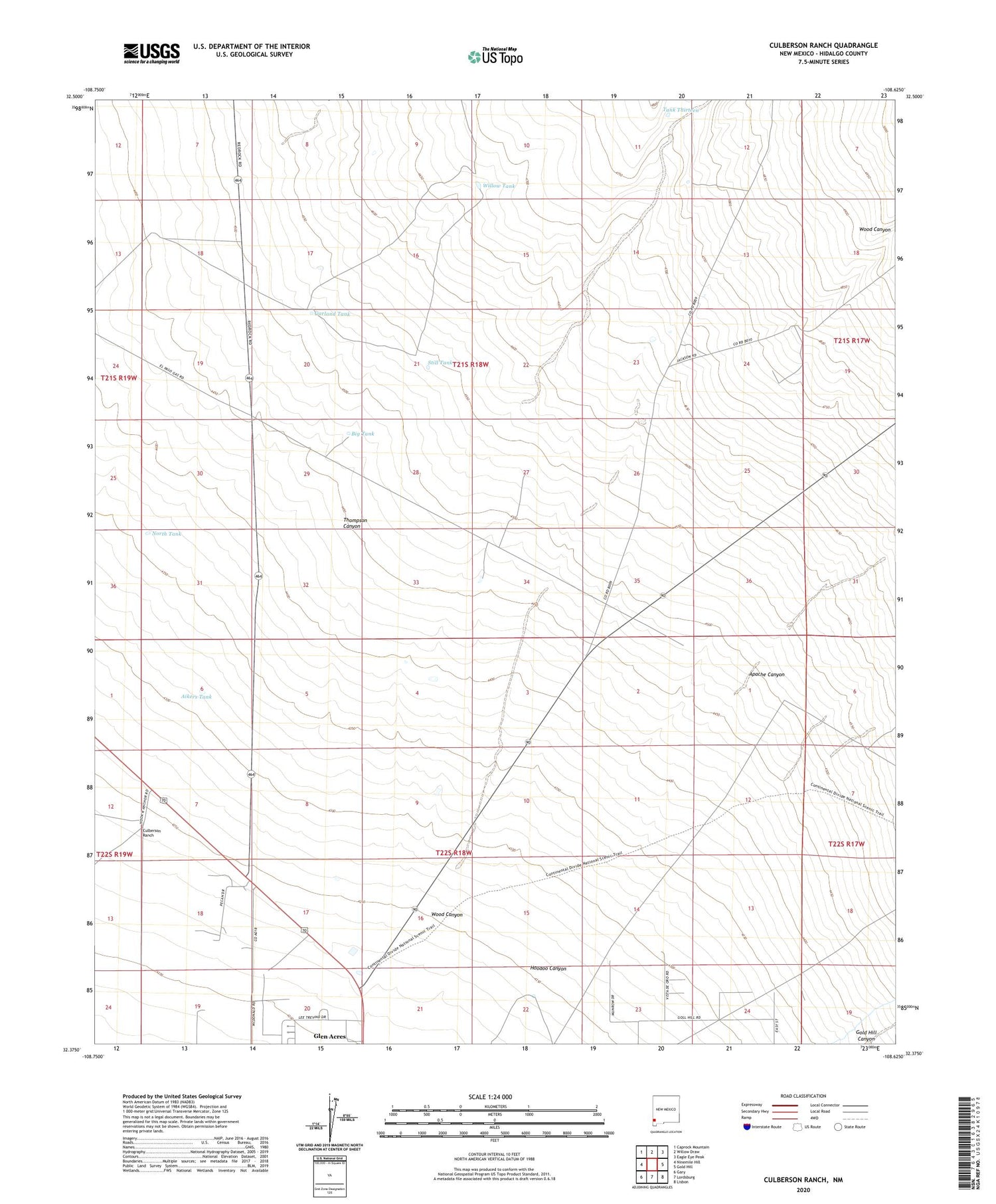
2020 topographic map quadrangle Culberson Ranch in the state of New Mexico. Scale: 1:24000. Based on the newly updated USGS 7.5' US Topo map series, this map is in the following counties: Hidalgo. The map contains contour data, water features, and other items you are used to seeing on USGS maps, but also has updated roads and other features. This is the next generation of topographic maps. Printed on high-quality waterproof paper with UV fade-resistant inks.
Quads adjacent to this one:
West: Ninemile Hill
Northwest: Caprock Mountain
North: Willow Draw
Northeast: Eagle Eye Peak
East: Gold Hill
Southeast: Lisbon
South: Lordsburg
Southwest: Gary
Contains the following named places: Aikers Tank, Apache Canyon, Ballard Windmill, Big Tank, Big Well, Culberson Ranch, Davis Windmill, Garland Tank, Glen Acres Census Designated Place, Hoodoo Canyon, Lordsburg Golf Club, Myers Windmill, North Tank, North Well, Reynolds Ranch, Still Tank, Tank Thirteen, Thompson Canyon, Willow Tank, Wood Canyon


