MyTopo
Eagle Eye Peak New Mexico US Topo Map
Couldn't load pickup availability
Also explore the Eagle Eye Peak Forest Service Topo of this same quad for updated USFS data
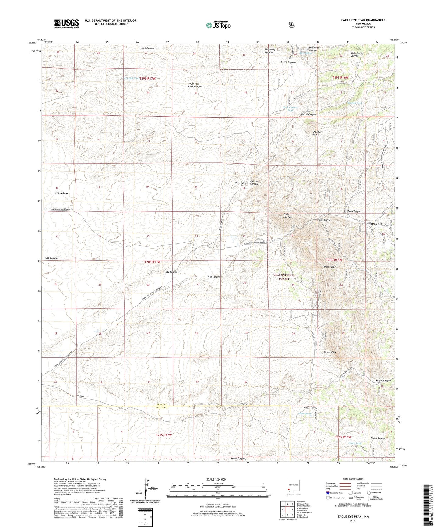
2023 topographic map quadrangle Eagle Eye Peak in the state of New Mexico. Scale: 1:24000. Based on the newly updated USGS 7.5' US Topo map series, this map is in the following counties: Grant, Hidalgo. The map contains contour data, water features, and other items you are used to seeing on USGS maps, but also has updated roads and other features. This is the next generation of topographic maps. Printed on high-quality waterproof paper with UV fade-resistant inks.
Quads adjacent to this one:
West: Willow Draw
Northwest: Redrock
North: Bullard Peak
Northeast: Wind Mountain
East: Burro Peak
Southeast: C Bar Ranch
South: Gold Hill
Southwest: Culberson Ranch
This map covers the same area as the classic USGS quad with code o32108e5.
Contains the following named places: Arrastre Gulch, Barrel Canyon, Bootleg Tank, Brock Ranch, Brock Ridge, Burro Spring, Chicken Canyon, Chocolate Peak, Chocolate Peak Dam, Cureton Ranch, Eagle Eye Peak, Fence Tank, Fred L Group, Gold Gulch, Knight Peak, Live Oak Tank, Lost Prospector Mine, Malone, Malone Mines, McCauley Ranch, Mill Canyon, Miller Spring, Mulberry Canyon, Pine Canyon, Ray Canyon, Ray Ranch, Road Canyon, Seep Canyon Tank, Thomson Canyon Perlite Deposit, Three Js Claims, Yankee Girl Mine