MyTopo
Ninemile Hill New Mexico US Topo Map
Couldn't load pickup availability
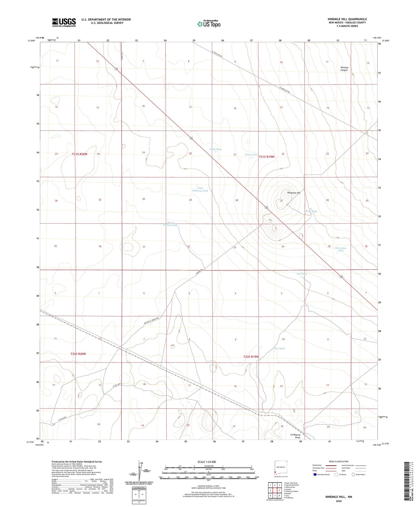
2023 topographic map quadrangle Ninemile Hill in the state of New Mexico. Scale: 1:24000. Based on the newly updated USGS 7.5' US Topo map series, this map is in the following counties: Hidalgo. The map contains contour data, water features, and other items you are used to seeing on USGS maps, but also has updated roads and other features. This is the next generation of topographic maps. Printed on high-quality waterproof paper with UV fade-resistant inks.
Quads adjacent to this one:
West: Summit
Northwest: Rock Tank Draw
North: Caprock Mountain
Northeast: Willow Draw
East: Culberson Ranch
Southeast: Lordsburg
South: Gary
Southwest: Mondel
This map covers the same area as the classic USGS quad with code o32108d7.
Contains the following named places: Adobe Windmill, Box M Ranch, Cottonwood Well, Flat Tank, Horseshoe Tank, House Pasture Tank, Jones Tank, Little Highway Tank, Malpais Windmill, Ninemile Hill, Odell Tank, Railroad Well, Red Tank, Rock Tank, Tenmile Canyon, Wright Well, ZIP Code: 88045