MyTopo
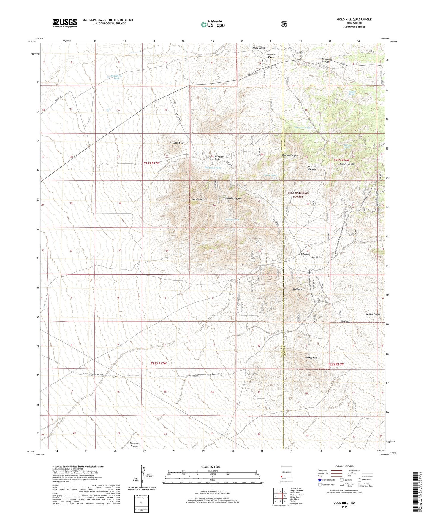
Gold Hill New Mexico US Topo Map
Couldn't load pickup availability
Also explore the Gold Hill Forest Service Topo of this same quad for updated USFS data
2023 topographic map quadrangle Gold Hill in the state of New Mexico. Scale: 1:24000. Based on the newly updated USGS 7.5' US Topo map series, this map is in the following counties: Hidalgo, Grant. The map contains contour data, water features, and other items you are used to seeing on USGS maps, but also has updated roads and other features. This is the next generation of topographic maps. Printed on high-quality waterproof paper with UV fade-resistant inks.
Quads adjacent to this one:
West: Culberson Ranch
Northwest: Willow Draw
North: Eagle Eye Peak
Northeast: Burro Peak
East: C Bar Ranch
Southeast: Ninetysix Ranch
South: Lisbon
Southwest: Lordsburg
This map covers the same area as the classic USGS quad with code o32108d5.
Contains the following named places: Apache Mountain, Apache Tank, Apache Wells, Bradberry Tank, Bradberry Windmill, Bruff Deposit, Cline Ranch, Contention Claim, Coop Mine, Coop Windmill, Crescent Deposit, Cuningham Windmill, Divide Windmill, Engineers Windmill, Gold Hill, Gold Hill Cemetery, Golden Cross Mine, Hoodoo Spring, Hornbrook Mountain, Hughes, Juniper Spring, McComas Incident Historical Marker, Mill Mine, Monarch Canyon, Monarch Tank, Muscovy Mine, Nancy Lee Mine, Never Fail Mine, Noonday Lode, North Tank, Oak Tank, Orogrande, Peterson Canyon, Peterson Spring, Peterson Tank, Picnic Canyon, Powerline Canyon, Reservation Mine, Round Mountain, Round Mountain Ranch, Ruby Mine, Standard Mine, Walker Mountain, Walker Windmill, Weatherfords Uranium Deposit, Werney Mine, White Rock Deposit, Wing Feather Lady, WO Ranch, Z X Canyon