MyTopo
Hosta Butte New Mexico US Topo Map
Couldn't load pickup availability
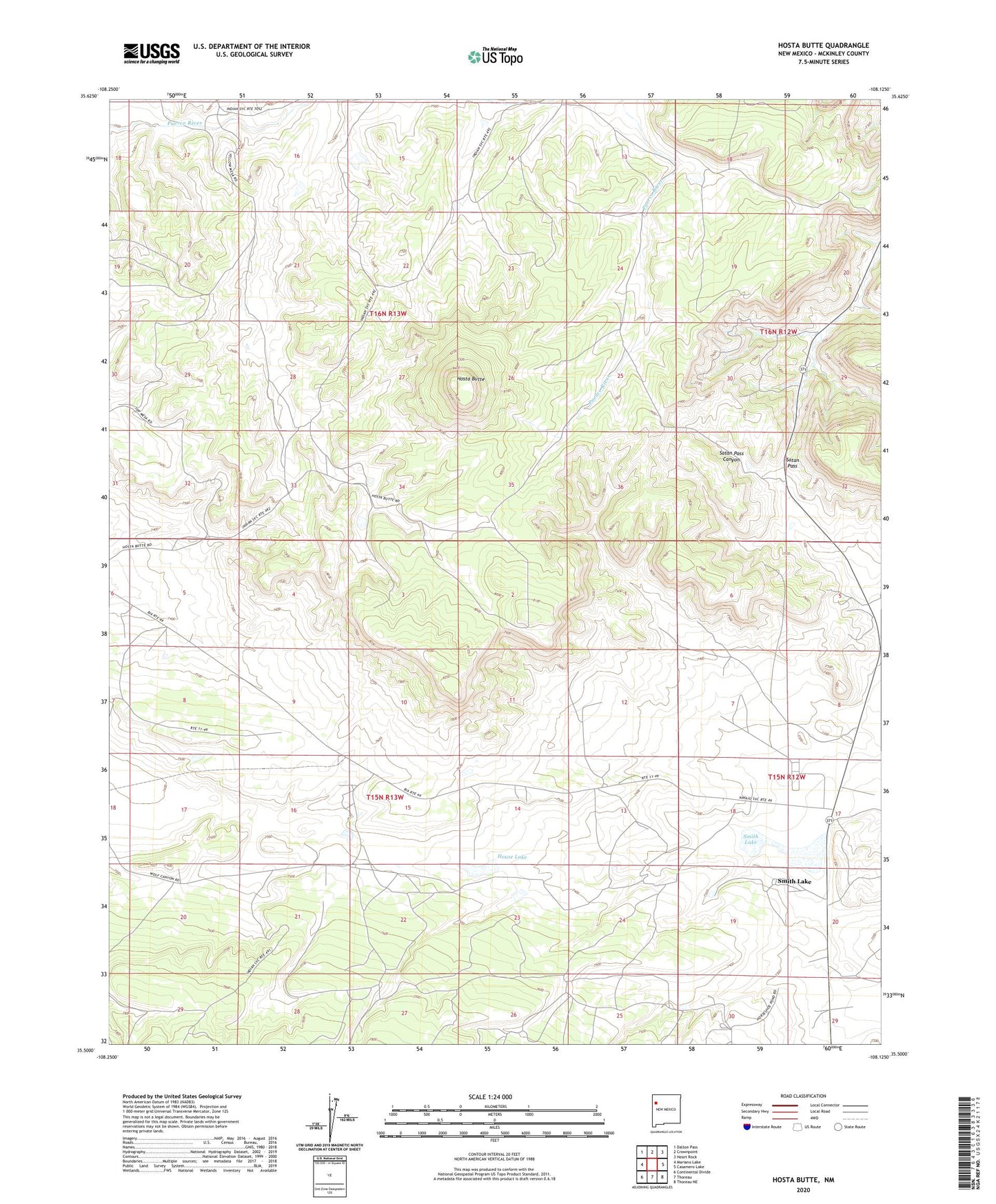
2023 topographic map quadrangle Hosta Butte in the state of New Mexico. Scale: 1:24000. Based on the newly updated USGS 7.5' US Topo map series, this map is in the following counties: McKinley. The map contains contour data, water features, and other items you are used to seeing on USGS maps, but also has updated roads and other features. This is the next generation of topographic maps. Printed on high-quality waterproof paper with UV fade-resistant inks.
Quads adjacent to this one:
West: Mariano Lake
Northwest: Dalton Pass
North: Crownpoint
Northeast: Heart Rock
East: Casamero Lake
Southeast: Thoreau NE
South: Thoreau
Southwest: Continental Divide
This map covers the same area as the classic USGS quad with code o35108e2.
Contains the following named places: 10013 Water Well, 16T-558 Water Well, Bethesda Navajo Mission, Black Jack Mine Number One, Childers Smith Reservoir Dam, Hall, Hosta Butte, House Lake, Satan Pass, Smith Lake, Smith Lake Chapter, Smith Lake Elementary School