MyTopo
Denton Camp New Mexico US Topo Map
Couldn't load pickup availability
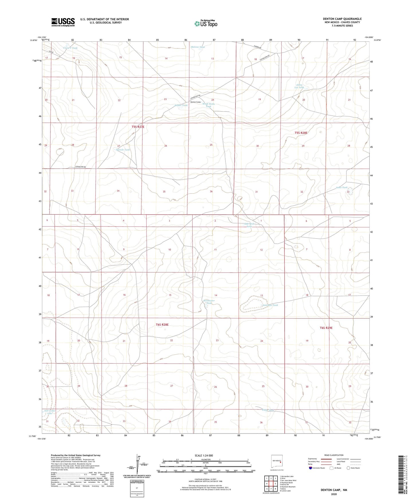
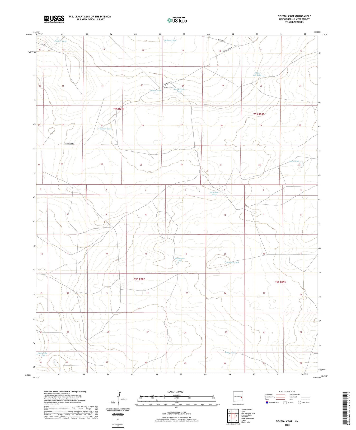
2020 topographic map quadrangle Denton Camp in the state of New Mexico. Scale: 1:24000. Based on the newly updated USGS 7.5' US Topo map series, this map is in the following counties: Chaves. The map contains contour data, water features, and other items you are used to seeing on USGS maps, but also has updated roads and other features. This is the next generation of topographic maps. Printed on high-quality waterproof paper with UV fade-resistant inks.
Quads adjacent to this one:
West: Haystack Butte
Northwest: Hernandez Lake
North: Olive
Northeast: San Juan Mesa West
East: Kenna SW
Southeast: Curlew Lake
South: Elkins
Southwest: Haystack Mountain
Contains the following named places: Alden Lee Tank, Anna Tank, Antelope Tank, Apache Windmill, Archer Tank, Beatonbough Windmill, Cedar Windmill, Circle Y Tank, Denton Camp, Denton L Seven Ranch, Denton Windmills, Junior Tank, Malone Tank, Pool Windmill, Rainwater Tank, Rainwater Windmill, Red Tank Windmill, Salt Well Tank, Salt Windmill, Sixmile Tank, Twin Windmills, Weak Wells Tank, West Windmill, White Tank