MyTopo
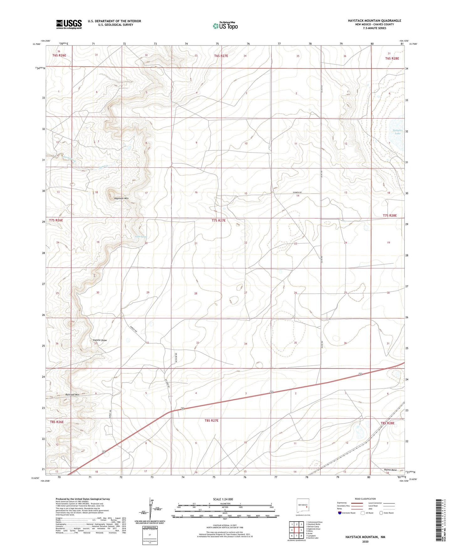
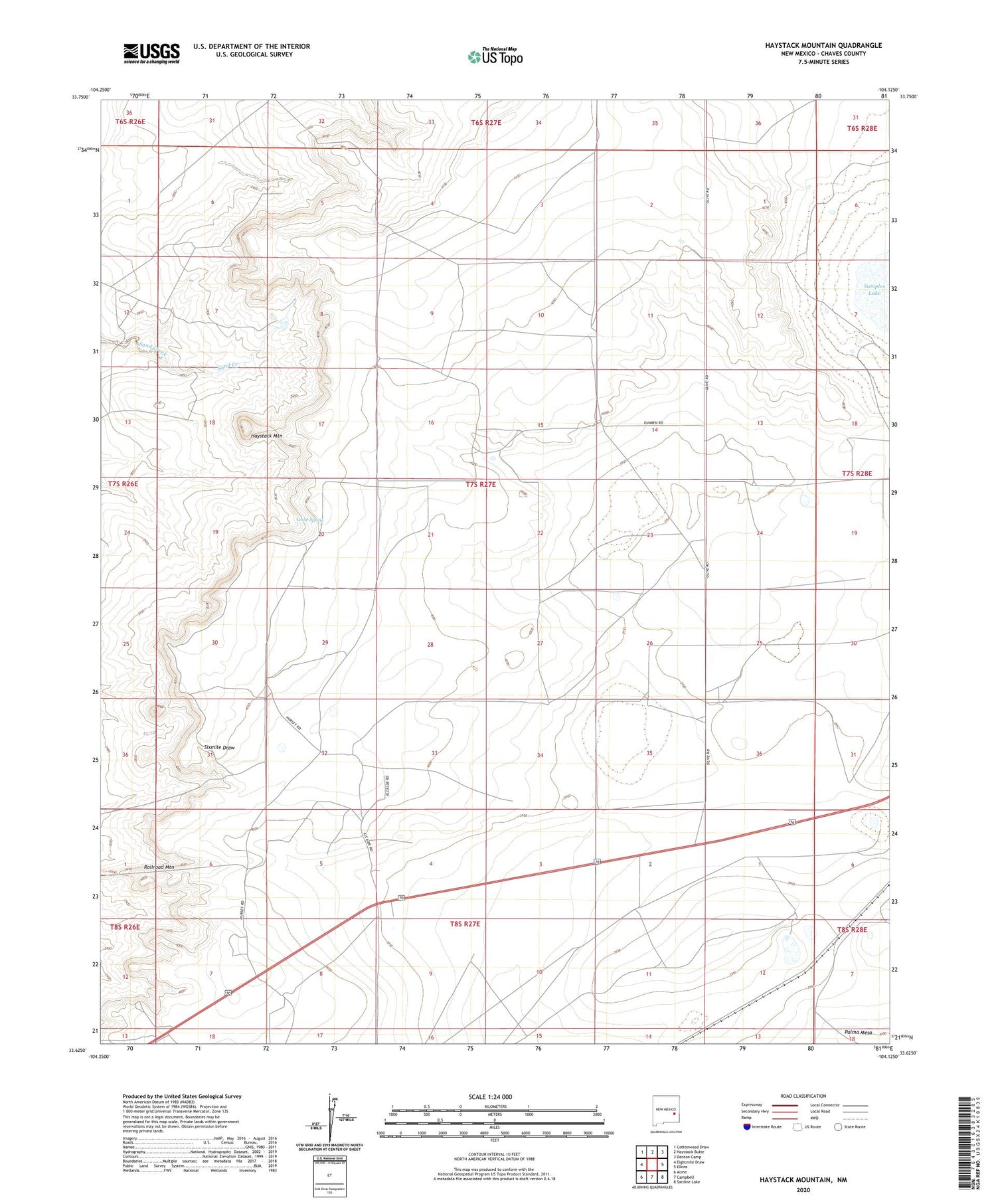
Haystack Mountain New Mexico US Topo Map
Couldn't load pickup availability
2023 topographic map quadrangle Haystack Mountain in the state of New Mexico. Scale: 1:24000. Based on the newly updated USGS 7.5' US Topo map series, this map is in the following counties: Chaves. The map contains contour data, water features, and other items you are used to seeing on USGS maps, but also has updated roads and other features. This is the next generation of topographic maps. Printed on high-quality waterproof paper with UV fade-resistant inks.
Quads adjacent to this one:
West: Eightmile Draw
Northwest: Cottonwood Draw
North: Haystack Butte
Northeast: Denton Camp
East: Elkins
Southeast: Sardine Lake
South: Campbell
Southwest: Acme
This map covers the same area as the classic USGS quad with code o33104f2.
Contains the following named places: Caliche Pit, Faircloth Ranch, Hackett Well, Haystack Mountain, High Lonesome, Leslie Spring, North Samples Well, Samples Windmill, Smith Ranch, South Samples Well, Williams Well