MyTopo
San Juan Mesa West New Mexico US Topo Map
Couldn't load pickup availability
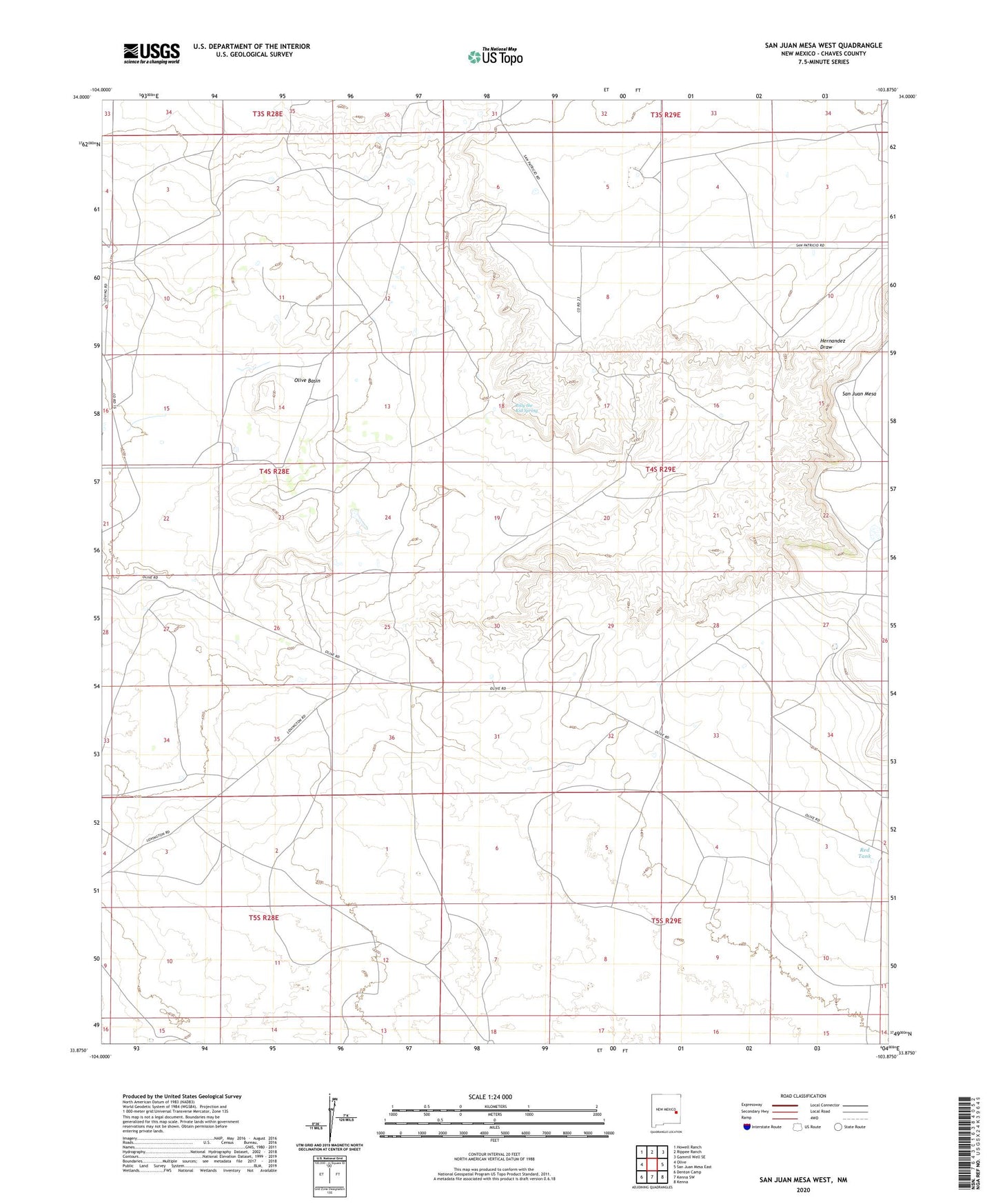
2023 topographic map quadrangle San Juan Mesa West in the state of New Mexico. Scale: 1:24000. Based on the newly updated USGS 7.5' US Topo map series, this map is in the following counties: Chaves. The map contains contour data, water features, and other items you are used to seeing on USGS maps, but also has updated roads and other features. This is the next generation of topographic maps. Printed on high-quality waterproof paper with UV fade-resistant inks.
Quads adjacent to this one:
West: Olive
Northwest: Howell Ranch
North: Rippee Ranch
Northeast: Gammil Well SE
East: San Juan Mesa East
Southeast: Kenna
South: Kenna SW
Southwest: Denton Camp
This map covers the same area as the classic USGS quad with code o33103h8.
Contains the following named places: Billy the Kid Spring, Braun Windmill, Red Tank, San Juan Mesa, ZIP Code: 88116