MyTopo
Haystack Butte New Mexico US Topo Map
Couldn't load pickup availability
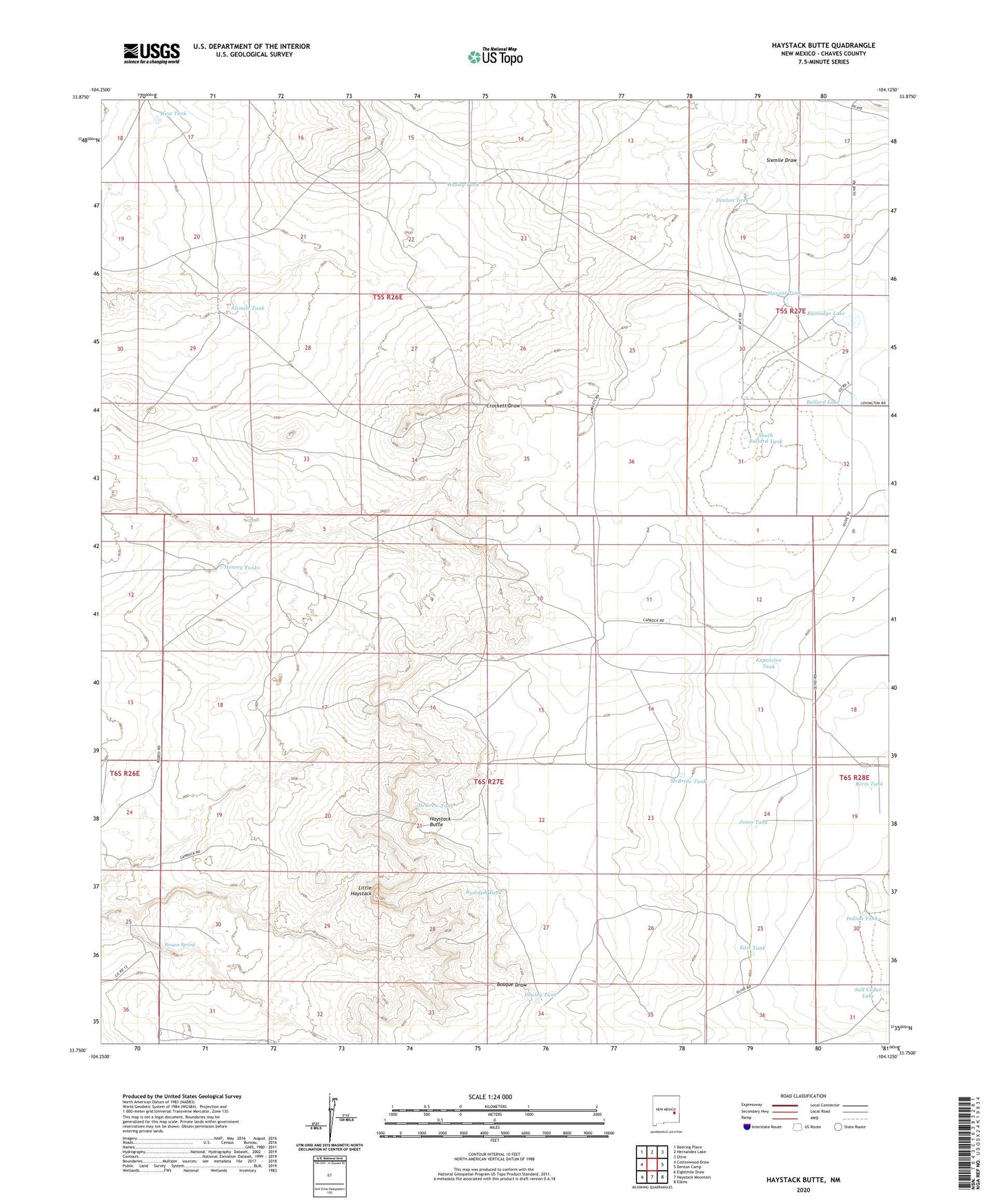
2023 topographic map quadrangle Haystack Butte in the state of New Mexico. Scale: 1:24000. Based on the newly updated USGS 7.5' US Topo map series, this map is in the following counties: Chaves. The map contains contour data, water features, and other items you are used to seeing on USGS maps, but also has updated roads and other features. This is the next generation of topographic maps. Printed on high-quality waterproof paper with UV fade-resistant inks.
Quads adjacent to this one:
West: Cottonwood Draw
Northwest: Deering Place
North: Hernandez Lake
Northeast: Olive
East: Denton Camp
Southeast: Elkins
South: Haystack Mountain
Southwest: Eightmile Draw
This map covers the same area as the classic USGS quad with code o33104g2.
Contains the following named places: 06300 Water Well, 06301 Water Well, 06302 Water Well, 06303 Water Well, Adams Well, Ballard Lake, Berts Tank, Bosque Spring, Chatten-Muncy Ranch, Cooper Ranch, Crockett Well, Denton Tank, Dooley Tank, East Tank, Expensive Tank, Havens Tank, Haystack Butte, Henery Tanks, Indian Tank, Jones Tank, Little Haystack, Lucky Strike Well, McBride Tank, McGrew Tank, Ramadge Lake, Rudolph Tank, Salt Cedar Lake, Salt Cedar Tank, Sixmile Tank, South Ballard Tank, South Van Eaton Ranch, Sulphur Well, Wesley Tank, West Tank, West Windmill