MyTopo
Hernandez Lake New Mexico US Topo Map
Couldn't load pickup availability
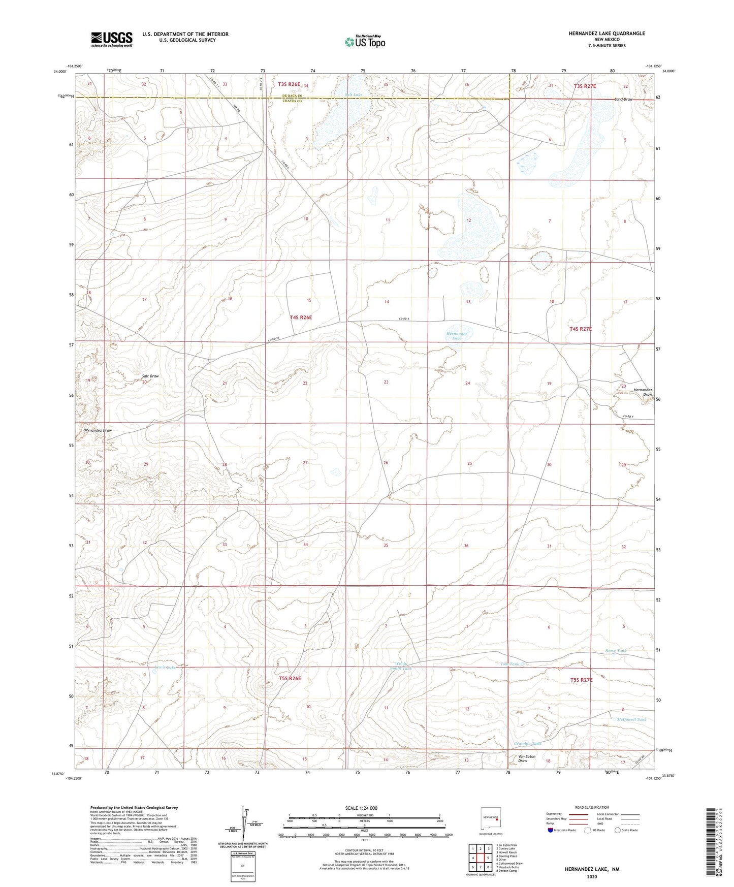
2023 topographic map quadrangle Hernandez Lake in the state of New Mexico. Scale: 1:24000. Based on the newly updated USGS 7.5' US Topo map series, this map is in the following counties: Chaves, De Baca. The map contains contour data, water features, and other items you are used to seeing on USGS maps, but also has updated roads and other features. This is the next generation of topographic maps. Printed on high-quality waterproof paper with UV fade-resistant inks.
Quads adjacent to this one:
West: Deering Place
Northwest: La Espia Peak
North: Cooley Lake
Northeast: Howell Ranch
East: Olive
Southeast: Denton Camp
South: Haystack Butte
Southwest: Cottonwood Draw
This map covers the same area as the classic USGS quad with code o33104h2.
Contains the following named places: Grandpa Tank, Hernandez Lake, Jane Well, Lewis Lake, McDowell Tank, Reese Tank, Salt Draw, Salt Lake, Salt Well, Sand Draw, The Old Well, Tom Tank, West Camp, West Windmill, Windy Smith Tank