MyTopo
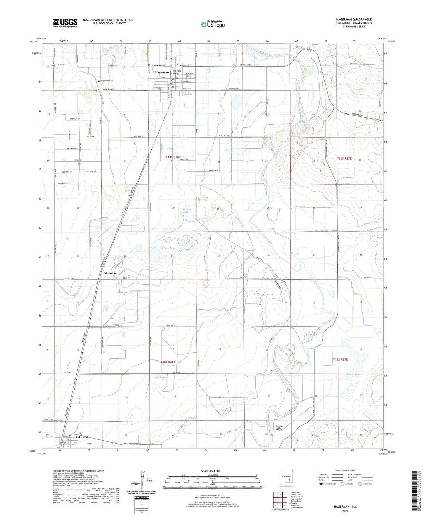
Hagerman New Mexico US Topo Map
Couldn't load pickup availability
2023 topographic map quadrangle Hagerman in the state of New Mexico. Scale: 1:24000. Based on the newly updated USGS 7.5' US Topo map series, this map is in the following counties: Chaves. The map contains contour data, water features, and other items you are used to seeing on USGS maps, but also has updated roads and other features. This is the next generation of topographic maps. Printed on high-quality waterproof paper with UV fade-resistant inks.
Quads adjacent to this one:
West: Hagerman SW
Northwest: Dexter West
North: Dexter East
Northeast: Bar C Bar Ranch
East: Derrick Draw
Southeast: Diamond Mound
South: Artesia NE
Southwest: Espuela
This map covers the same area as the classic USGS quad with code o33104a3.
Contains the following named places: Assembly of God Church, Buffalo Lake, Buffalo Valley, Buffalo Valley Farm, Church of Christ, First Assembly of God Church, First Baptist Church, First Church of the Nazarene, First United Methodist Church, Full Gospel Mission, Hagerman, Hagerman Cemetery, Hagerman Community Library, Hagerman Elementary School, Hagerman High School, Hagerman Junior High School, Hagerman Police Department, Hagerman Post Office, Hagerman Volunteer Fire Department / Hagerman Ambulance Service Station 1, Hagerman Volunteer Fire Department / Hagerman Ambulance Service Station 2, Hagerman Weather Station, Lake Arthur, Lake Tolliver, Long Arroyo, Mossman, Prichard Lake, Prichard Lakes, Rio Feliz Bridge, Seventh Day Adventist Church, Spanish Church of Christ, Town of Hagerman