MyTopo
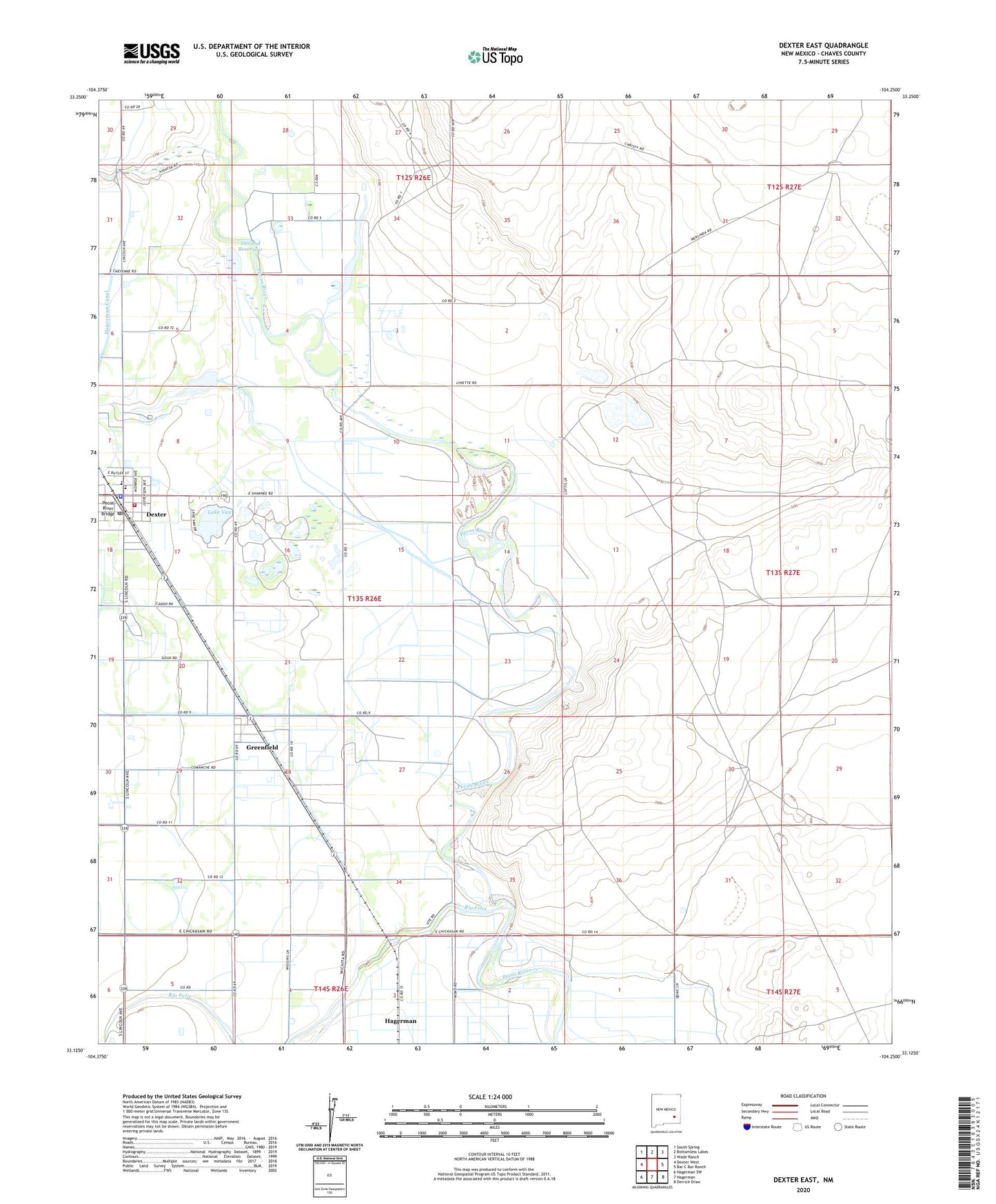
Dexter East New Mexico US Topo Map
Couldn't load pickup availability
2023 topographic map quadrangle Dexter East in the state of New Mexico. Scale: 1:24000. Based on the newly updated USGS 7.5' US Topo map series, this map is in the following counties: Chaves. The map contains contour data, water features, and other items you are used to seeing on USGS maps, but also has updated roads and other features. This is the next generation of topographic maps. Printed on high-quality waterproof paper with UV fade-resistant inks.
Quads adjacent to this one:
West: Dexter West
Northwest: South Spring
North: Bottomless Lakes
Northeast: Wade Ranch
East: Bar C Bar Ranch
Southeast: Derrick Draw
South: Hagerman
Southwest: Hagerman SW
This map covers the same area as the classic USGS quad with code o33104b3.
Contains the following named places: Calumet Ranch, Church of Christ, Dexter, Dexter Elementary School, Dexter Fire and Rescue Station 1, Dexter High School, Dexter Junior High School, Dexter National Fish Hatchery and Fish Technology Center, Dexter Police Department, Dexter Post Office, Dexter Public Library, Dexter Sewage Disposal Plant, Durand Reservoir, Eastside Church of Christ, First Baptist Church, First Methodist Church, First Presbyterian Church, Greenfield, Greenfield Post Office, Lake Van, Lake Van Rod Club, Midway Baptist Church, Pecos River Bridge, Primera Iglesia Bautista, Rio Felix, Spring Mound Valley Cemetery, Town of Dexter, Westside Church of Christ, Zuber Hollow Reservoir Dam