MyTopo
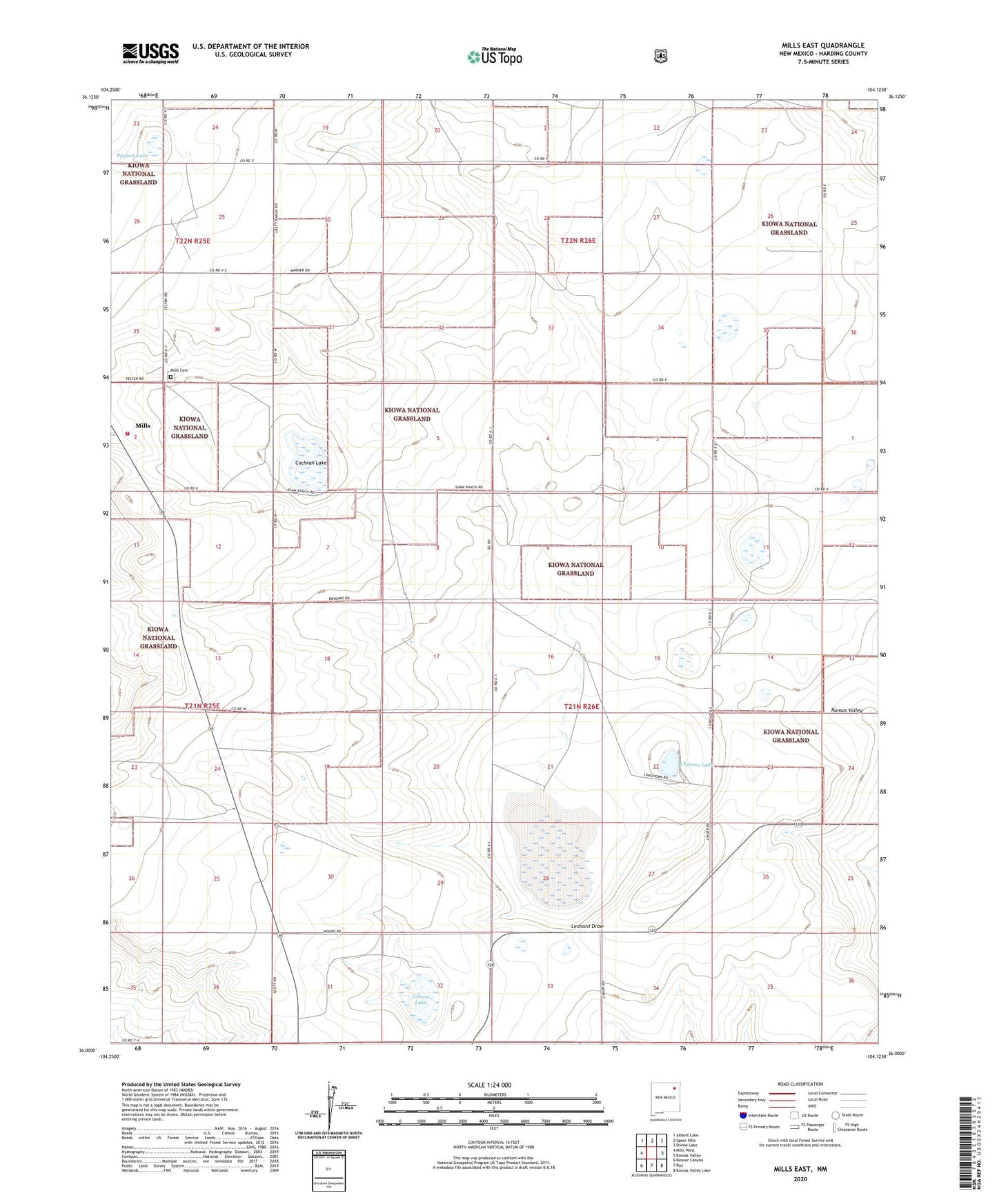
Mills East New Mexico US Topo Map
Couldn't load pickup availability
Also explore the Mills East Forest Service Topo of this same quad for updated USFS data
2023 topographic map quadrangle Mills East in the state of New Mexico. Scale: 1:24000. Based on the newly updated USGS 7.5' US Topo map series, this map is in the following counties: Harding. The map contains contour data, water features, and other items you are used to seeing on USGS maps, but also has updated roads and other features. This is the next generation of topographic maps. Printed on high-quality waterproof paper with UV fade-resistant inks.
Quads adjacent to this one:
West: Mills West
Northwest: Abbott Lake
North: Spear Hills
Northeast: Divine Lake
East: Kansas Valley
Southeast: Kansas Valley Lake
South: Roy
Southwest: Beaver Canyon
This map covers the same area as the classic USGS quad with code o36104a2.
Contains the following named places: Big Chicosa Lake, Bonomo, Chicosa Lake, Chicosa Lake State Park, Cochran Lake, Cogo Windmill, Dorhman Lake, Dry lake, Feltens, Fluhman, Freeman Windmill, Gibson Lake, Green, Harding County Fire District 1 Mills Substation, Leonard Draw, Meikle Windmill, Mills Cemetery, New Goodnight Trail Historical Marker, Payton Lake, Rigoni Landing Strips, Short Windmill