MyTopo
Dunlap Sill New Mexico US Topo Map
Couldn't load pickup availability
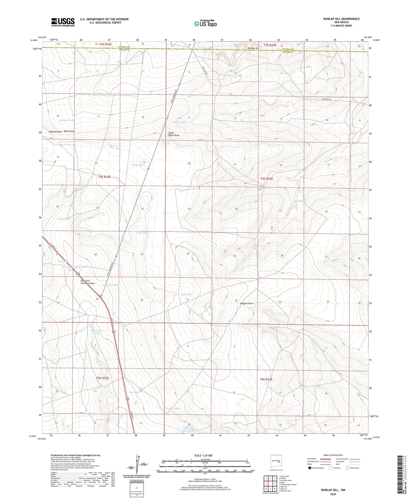
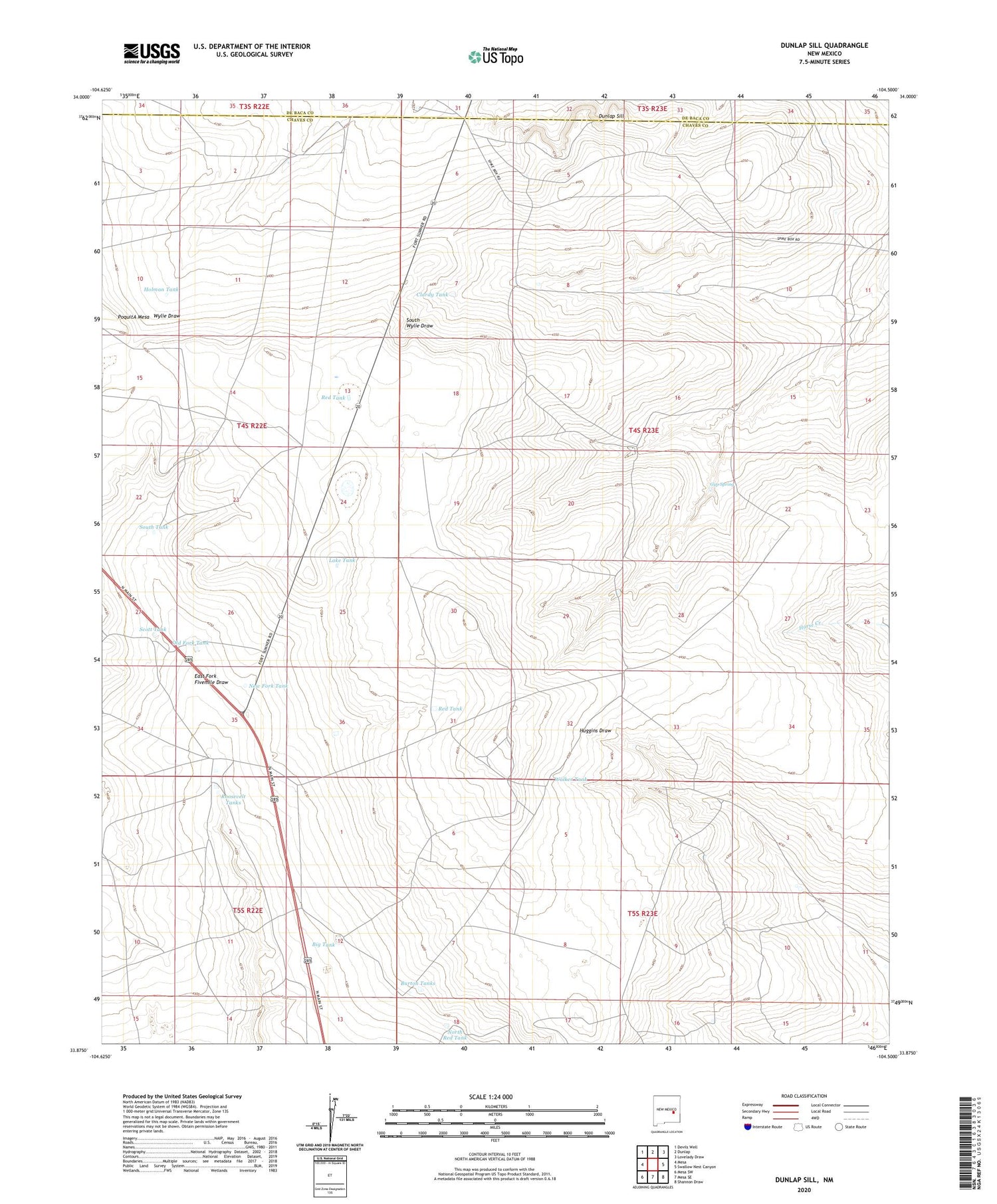
2020 topographic map quadrangle Dunlap Sill in the state of New Mexico. Scale: 1:24000. Based on the newly updated USGS 7.5' US Topo map series, this map is in the following counties: Chaves, De Baca. The map contains contour data, water features, and other items you are used to seeing on USGS maps, but also has updated roads and other features. This is the next generation of topographic maps. Printed on high-quality waterproof paper with UV fade-resistant inks.
Quads adjacent to this one:
West: Mesa
Northwest: Devils Well
North: Dunlap
Northeast: Lovelady Draw
East: Swallow Nest Canyon
Southeast: Shannon Draw
South: Mesa SE
Southwest: Mesa SW
Contains the following named places: Barnhill Windmill, Big Tank, Burton Tanks, Clardy Tank, Cox Well, Deep Well, Dunlap Sill, Gyp Spring, Hilltop Well, Hogue Well, Holman Tank, Lake Tank, Martin Ranch, New Fork Tank, North Red Tank, Old Fork Tank, Pollard Windmill, PoquitA Mesa, Red Tank, Red Windmill, Rock House, Roosevelt Tanks, Scott Tank, South Tank, Steel Windmills, Walker Tank