MyTopo
Devils Well New Mexico US Topo Map
Couldn't load pickup availability
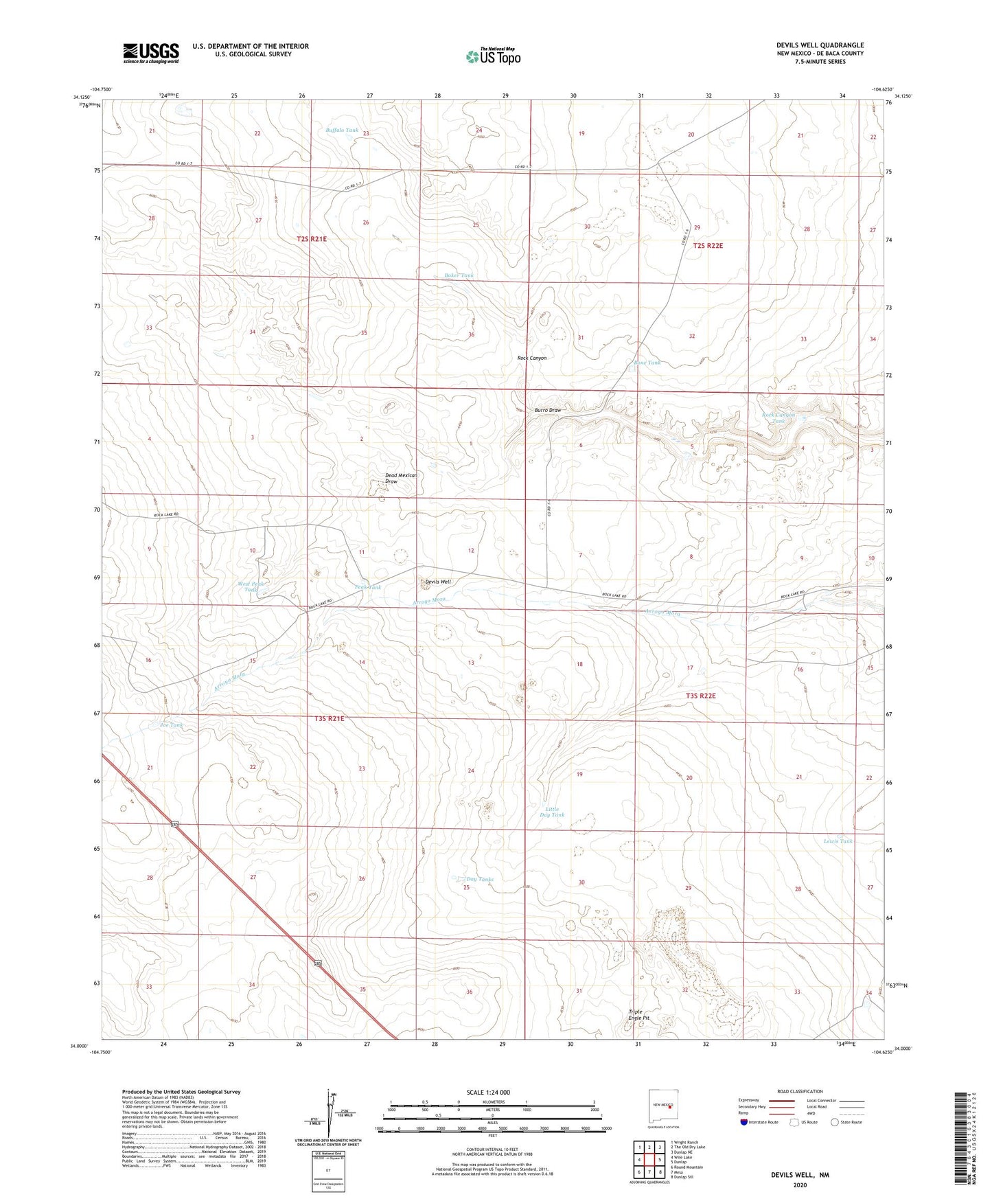
2023 topographic map quadrangle Devils Well in the state of New Mexico. Scale: 1:24000. Based on the newly updated USGS 7.5' US Topo map series, this map is in the following counties: De Baca. The map contains contour data, water features, and other items you are used to seeing on USGS maps, but also has updated roads and other features. This is the next generation of topographic maps. Printed on high-quality waterproof paper with UV fade-resistant inks.
Quads adjacent to this one:
West: Wire Lake
Northwest: Wright Ranch
North: The Old Dry Lake
Northeast: Dunlap NE
East: Dunlap
Southeast: Dunlap Sill
South: Mesa
Southwest: Round Mountain
This map covers the same area as the classic USGS quad with code o34104a6.
Contains the following named places: Baker Tank, Baker Well, Bone Tank, Buck Well, Buffalo Tank, Burro Draw, Day Tanks, Dead Mexican Draw, Devils Well, Joe Tank, Lewis Tank, Little Day Tank, Morris Well, Old Military Road, Peak Tank, Rock Canyon Tank, Triple Engle Pit, West Peak Tank