MyTopo
Dunlap New Mexico US Topo Map
Couldn't load pickup availability
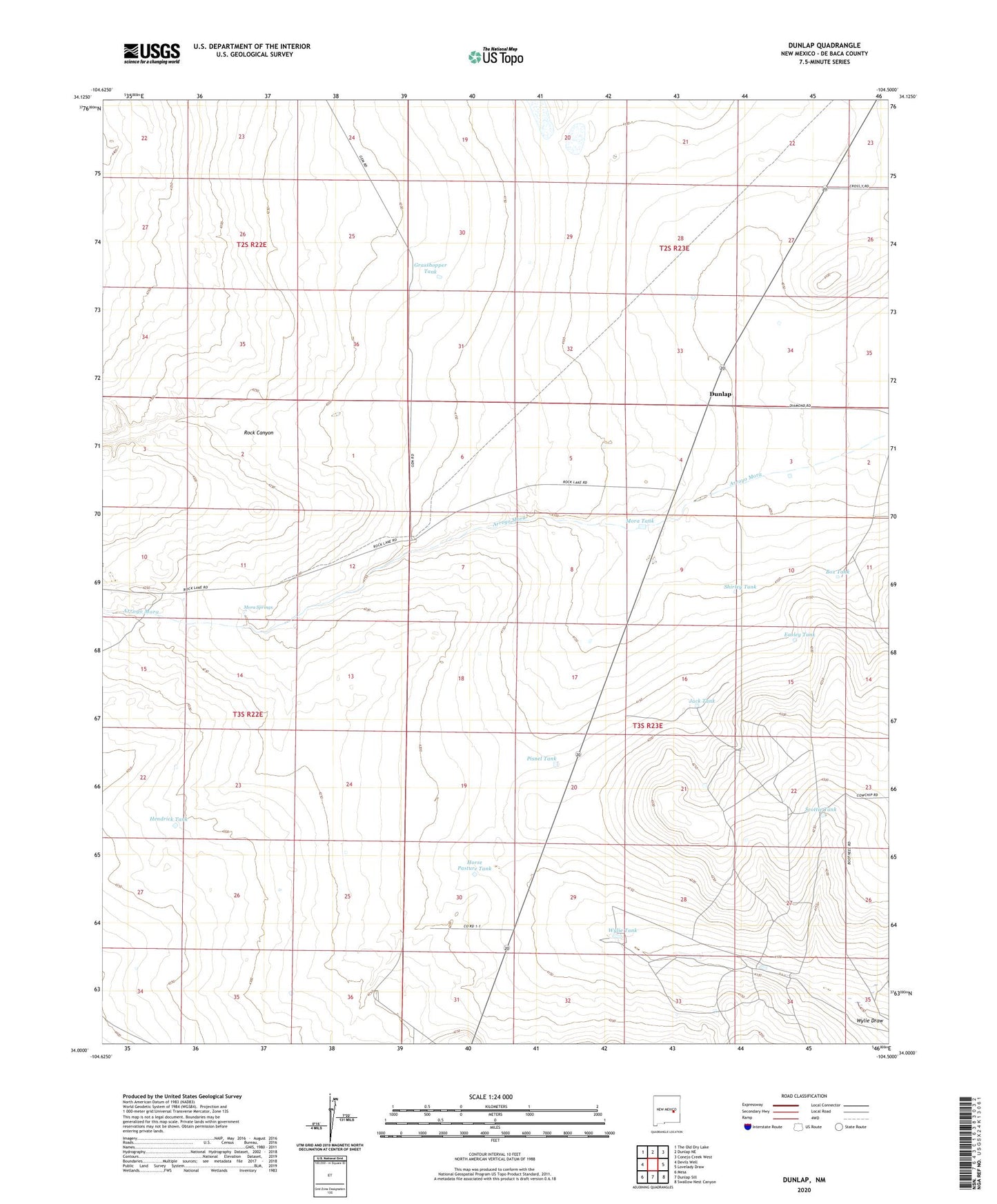
2023 topographic map quadrangle Dunlap in the state of New Mexico. Scale: 1:24000. Based on the newly updated USGS 7.5' US Topo map series, this map is in the following counties: De Baca. The map contains contour data, water features, and other items you are used to seeing on USGS maps, but also has updated roads and other features. This is the next generation of topographic maps. Printed on high-quality waterproof paper with UV fade-resistant inks.
Quads adjacent to this one:
West: Devils Well
Northwest: The Old Dry Lake
North: Dunlap NE
Northeast: Conejo Creek West
East: Lovelady Draw
Southeast: Swallow Nest Canyon
South: Dunlap Sill
Southwest: Mesa
This map covers the same area as the classic USGS quad with code o34104a5.
Contains the following named places: Box Tank, Dunlap, Dunlap Post Office, Easley Tank, East Windmill, Grasshopper Tank, Hendrick Tank, Horse Pasture Tank, Jack Tank, Key Ranch, King Windmill, Martin Ranch, Mora Springs, Mora Tank, North Windmill, Pisnel Tank, Rock Canyon, Scottie Tank, Sheppard Windmill, Shirley Tank, Sulphur Windmill, Wylie Tank