
MyTopo
East Mesa New Mexico US Topo Map
Couldn't load pickup availability
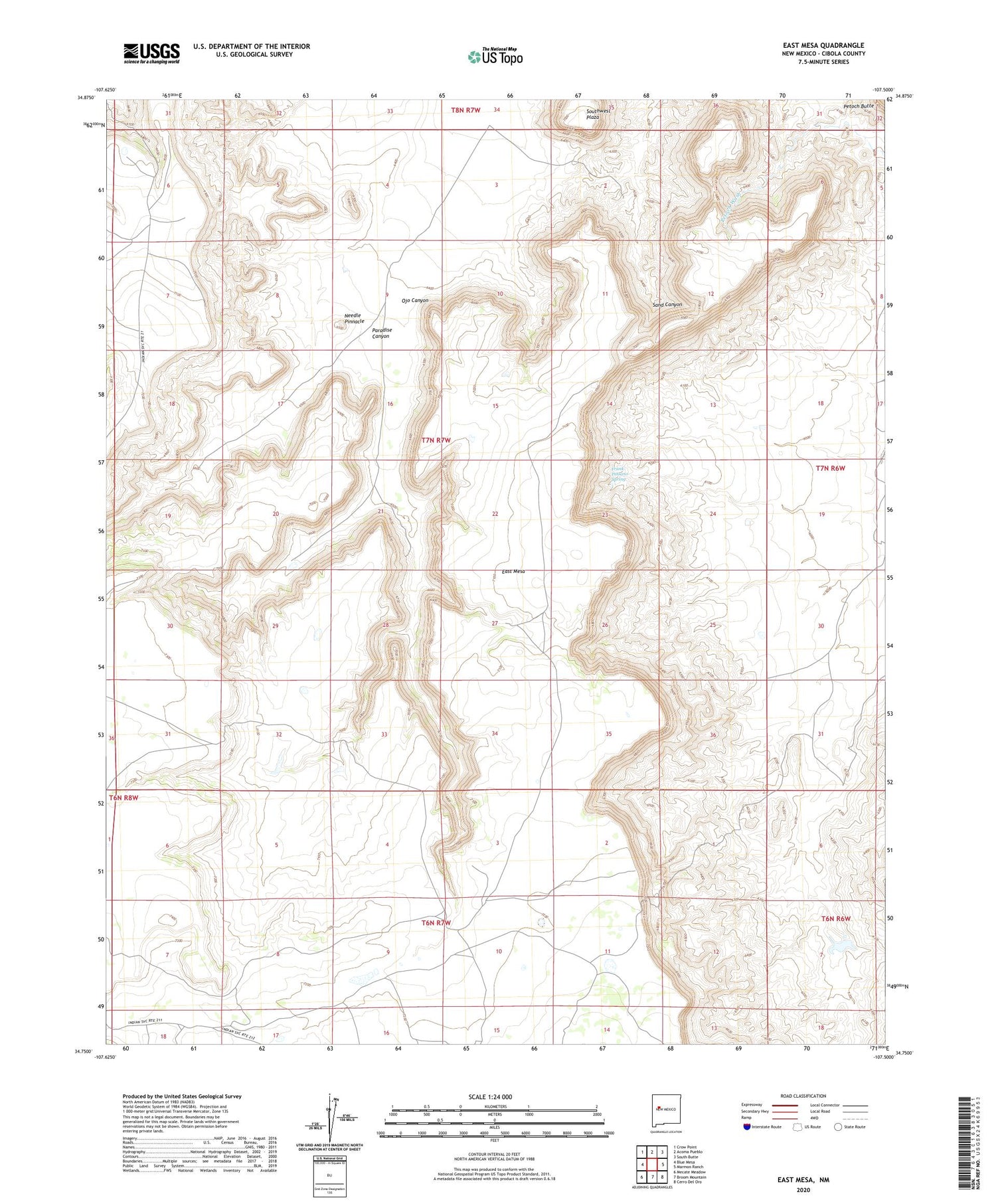
2020 topographic map quadrangle East Mesa in the state of New Mexico. Scale: 1:24000. Based on the newly updated USGS 7.5' US Topo map series, this map is in the following counties: Cibola. The map contains contour data, water features, and other items you are used to seeing on USGS maps, but also has updated roads and other features. This is the next generation of topographic maps. Printed on high-quality waterproof paper with UV fade-resistant inks.
Quads adjacent to this one:
West: Blue Mesa
Northwest: Crow Point
North: Acoma Pueblo
Northeast: South Butte
East: Marmon Ranch
Southeast: Cerro Del Oro
South: Broom Mountain
Southwest: Mecate Meadow
Contains the following named places: Acoma Number 6 Water Well, East Mesa, Frank Paisano Spring, Needle Pinnacle, Ojo Canyon, Paradise Canyon, Petaca Pinta Dam, Sarracino Ranch, Southwest Plaza, Wilson Windmill, ZIP Code: 87034


