MyTopo
Broom Mountain New Mexico US Topo Map
Couldn't load pickup availability
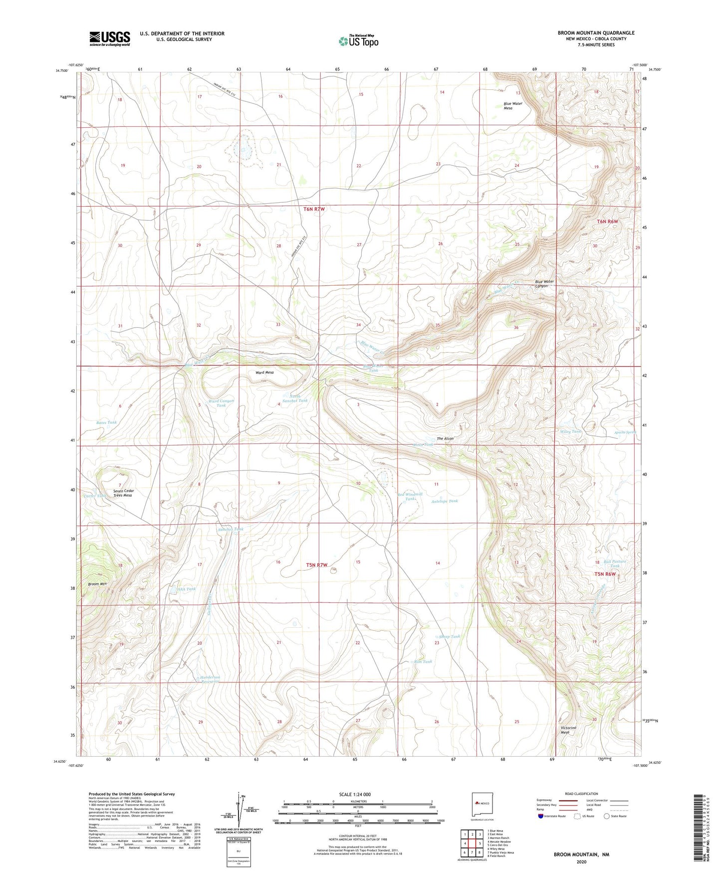
2023 topographic map quadrangle Broom Mountain in the state of New Mexico. Scale: 1:24000. Based on the newly updated USGS 7.5' US Topo map series, this map is in the following counties: Cibola. The map contains contour data, water features, and other items you are used to seeing on USGS maps, but also has updated roads and other features. This is the next generation of topographic maps. Printed on high-quality waterproof paper with UV fade-resistant inks.
Quads adjacent to this one:
West: Mecate Meadow
Northwest: Blue Mesa
North: East Mesa
Northeast: Marmon Ranch
East: Cerro Del Oro
Southeast: Field Ranch
South: Pueblo Viejo Mesa
Southwest: Wiley Mesa
This map covers the same area as the classic USGS quad with code o34107f5.
Contains the following named places: AAA Tank, Alcon Tank, Antelope Tank, Apache Spring, Bates Tank, Blue Water Canyon, Blue Water Mesa, Blue Water Tank, Broom Mountain, Bull Pasture Tank, Carter Tank, Henderson Reservoir, Henderson Water Well, Henderson Windmill, North Sanchez Tank, Red Windmill Tank, Rim Tank, Sanchez Tank, Seven Cedar Trees Mesa, Sheep Tank, The Alcon, Upper Boulder Detention Dam, Ward Canyon Tank, Ward Mesa, Ward Windmill, Wiley Tank