MyTopo
El Rito New Mexico US Topo Map
Couldn't load pickup availability
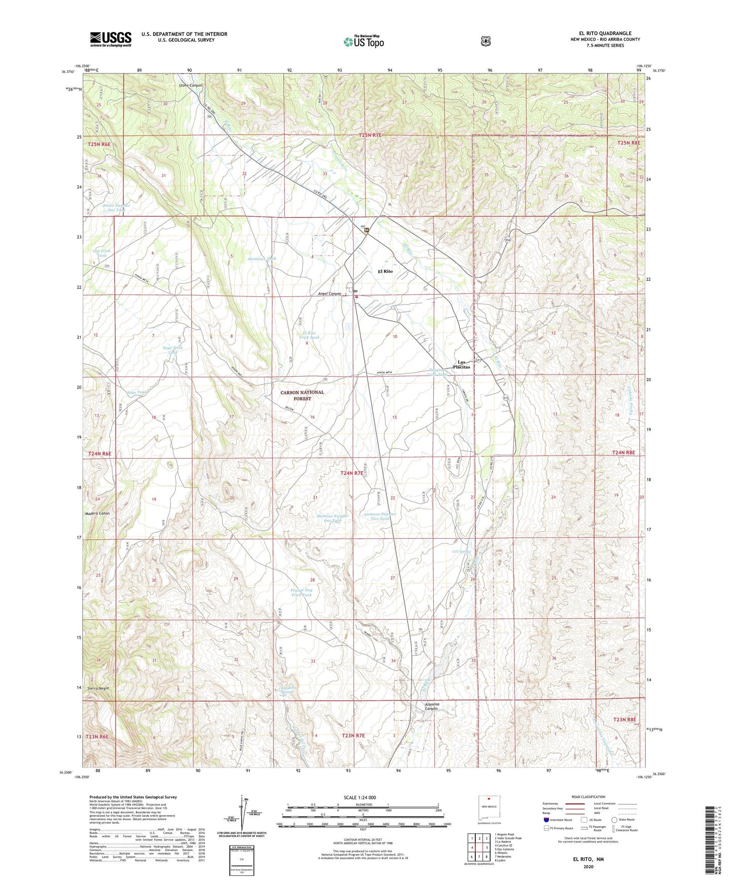
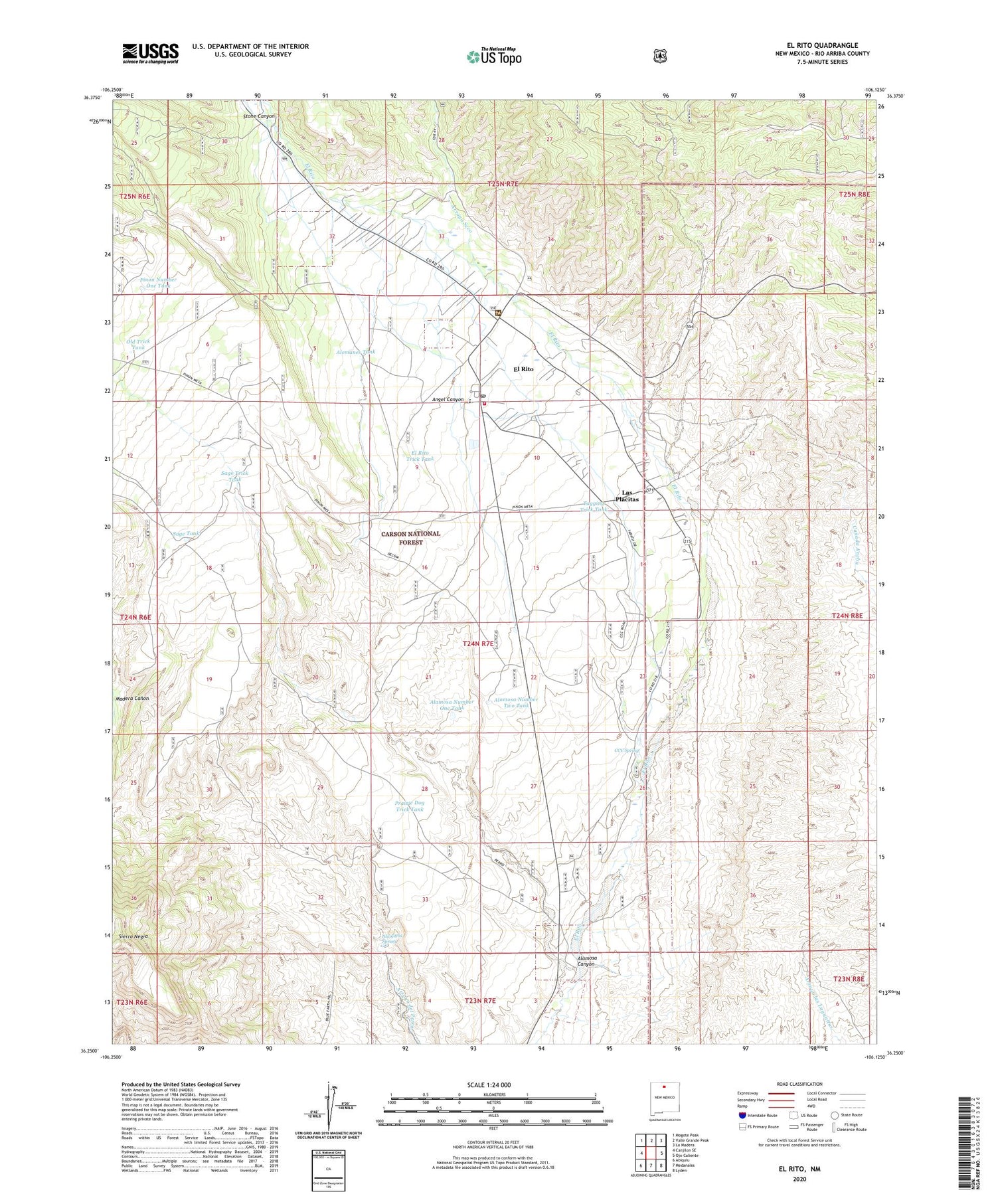
2020 topographic map quadrangle El Rito in the state of New Mexico. Scale: 1:24000. Based on the newly updated USGS 7.5' US Topo map series, this map is in the following counties: Rio Arriba. The map contains contour data, water features, and other items you are used to seeing on USGS maps, but also has updated roads and other features. This is the next generation of topographic maps. Printed on high-quality waterproof paper with UV fade-resistant inks.
Quads adjacent to this one:
West: Canjilon SE
Northwest: Mogote Peak
North: Valle Grande Peak
Northeast: La Madera
East: Ojo Caliente
Southeast: Lyden
South: Medanales
Southwest: Abiquiu
Contains the following named places: Acequia del Camino, Acequia del Jaral, Acequia del Madre, Acequia del Monte, Acequia Medio, Alamittos Spring, Alamosa Canyon, Alamosa Number One Tank, Alamosa Number Two Tank, Alemanes Tank, Angel Canyon, Arroyo Seco, CCC Spring, Cementerio de San Juan Nepomuseno, Delgado Hall Historic Site, El Rito, El Rito Campus, El Rito Census Designated Place, El Rito Community Cemetery, El Rito Community United Methodist Church, El Rito District Ranger Office, El Rito Historical Marker, El Rito Normal School, El Rito Post Office, El Rito Public Library, El Rito Trick Tank, El Rito Volunteer Fire Department, El Rito Weather Station, La Clinica del Norte, Las Placitas, Las Placitas Census Designated Place, Northern New Mexico Community College, Old Trick Tank, Pinon Number One Tank, Pinon Number Two Tank, Prairie Dog Trick Tank, RG-11855 Water Well, RG-12986 Water Well, RG-15700 Water Well, RG-22770 Water Well, Sage Tank, Sage Trick Tank, Sierra Negra, Southwestern Mine, Stone Canyon, Tagging Trick Tank, Trujillo School, ZIP Code: 87530