MyTopo
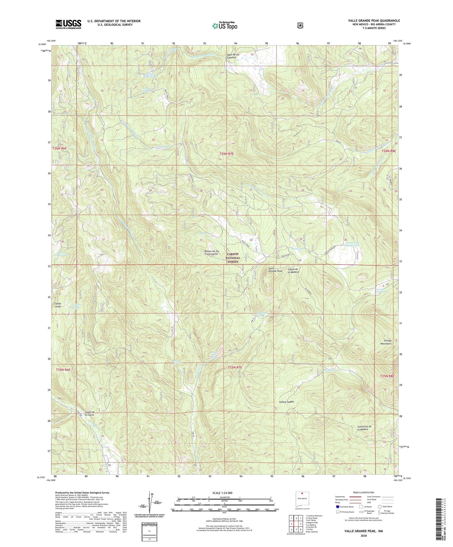
Valle Grande Peak New Mexico US Topo Map
Couldn't load pickup availability
Also explore the Valle Grande Peak Forest Service Topo of this same quad for updated USFS data
2023 topographic map quadrangle Valle Grande Peak in the state of New Mexico. Scale: 1:24000. Based on the newly updated USGS 7.5' US Topo map series, this map is in the following counties: Rio Arriba. The map contains contour data, water features, and other items you are used to seeing on USGS maps, but also has updated roads and other features. This is the next generation of topographic maps. Printed on high-quality waterproof paper with UV fade-resistant inks.
Quads adjacent to this one:
West: Mogote Peak
Northwest: Canjilon Mountain
North: Canon Plaza
Northeast: Las Tablas
East: La Madera
Southeast: Ojo Caliente
South: El Rito
Southwest: Canjilon SE
This map covers the same area as the classic USGS quad with code o36106d2.
Contains the following named places: Arroyo Seco Spring, Borracho Forest Service Facility, Bull Tank, Calavera Spring, Canada de la Jarita, Canada del Potrero, Canada del Puertecito, Canada del Rancho, Canada Piedra Amarilla, Canon de la Cueva, Canon Largo Tank, Chupa Rosas Tank, El Rito Ranger District, Jacal De Palo Spring, Jarita Tank, Jarita Tank Number Two, La Cueva Springs, La Jarita Ranches, La Madera Mountain, Los Gatos Tank, Martinez Tank, Middle Fork Canada del Agua, North Fork Canada del Agua, Ortega Tank, Osa Spring, Petrero Waterfall, Posos Spring, Rincon de Tio Francisquito, Sotano Saddle, Sotano Tank, South Fork Canada del Agua, Truck Trail Tank, Valle Grande Peak, Valle Grande Truck Trail