MyTopo
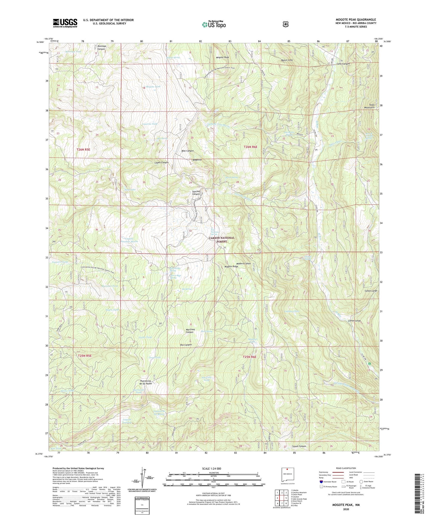
Mogote Peak New Mexico US Topo Map
Couldn't load pickup availability
Also explore the Mogote Peak Forest Service Topo of this same quad for updated USFS data
2023 topographic map quadrangle Mogote Peak in the state of New Mexico. Scale: 1:24000. Based on the newly updated USGS 7.5' US Topo map series, this map is in the following counties: Rio Arriba. The map contains contour data, water features, and other items you are used to seeing on USGS maps, but also has updated roads and other features. This is the next generation of topographic maps. Printed on high-quality waterproof paper with UV fade-resistant inks.
Quads adjacent to this one:
West: Canjilon
Northwest: Cebolla
North: Canjilon Mountain
Northeast: Canon Plaza
East: Valle Grande Peak
Southeast: El Rito
South: Canjilon SE
Southwest: Ghost Ranch
This map covers the same area as the classic USGS quad with code o36106d3.
Contains the following named places: Acre of Troughs Spring, Alamo Tank, Amarilla Tank, Banco Aragon, Banco Lona, Blas Spring, Canada Jose Maria, Canada Sierra, Canevas Tank, Cano Canyon, Canon Largo, Cholejo Spring, Deep Lake, East Sisneras Spring, El Rito Picnic Grounds, Elk Spring, Harris Bear Camp, Harris Bear Spring, Jose Maria Spring, Laguna Chico, Laguna de las Ranas, Laguna Lorenza, Laguna Pinabete Mocho, Llamo Tank, Lucky Tank, Madera Tank, Martinez Tank, Maton de la Jara, Mogote Peak, Mogote Ridge, Mogote Spring, Mogote Tank, Mogotito, Montoya Tank, Negro Tank, Ojito Chico, Oso Tank, Puertecito de las Ranas, Puertecito Tank, Rancherilla Spring, Rim Tank, Rock Spring, Sheep Tank, Sierra Spring, Toro Tank, Tusas Mountains, Vaquero Tank