MyTopo
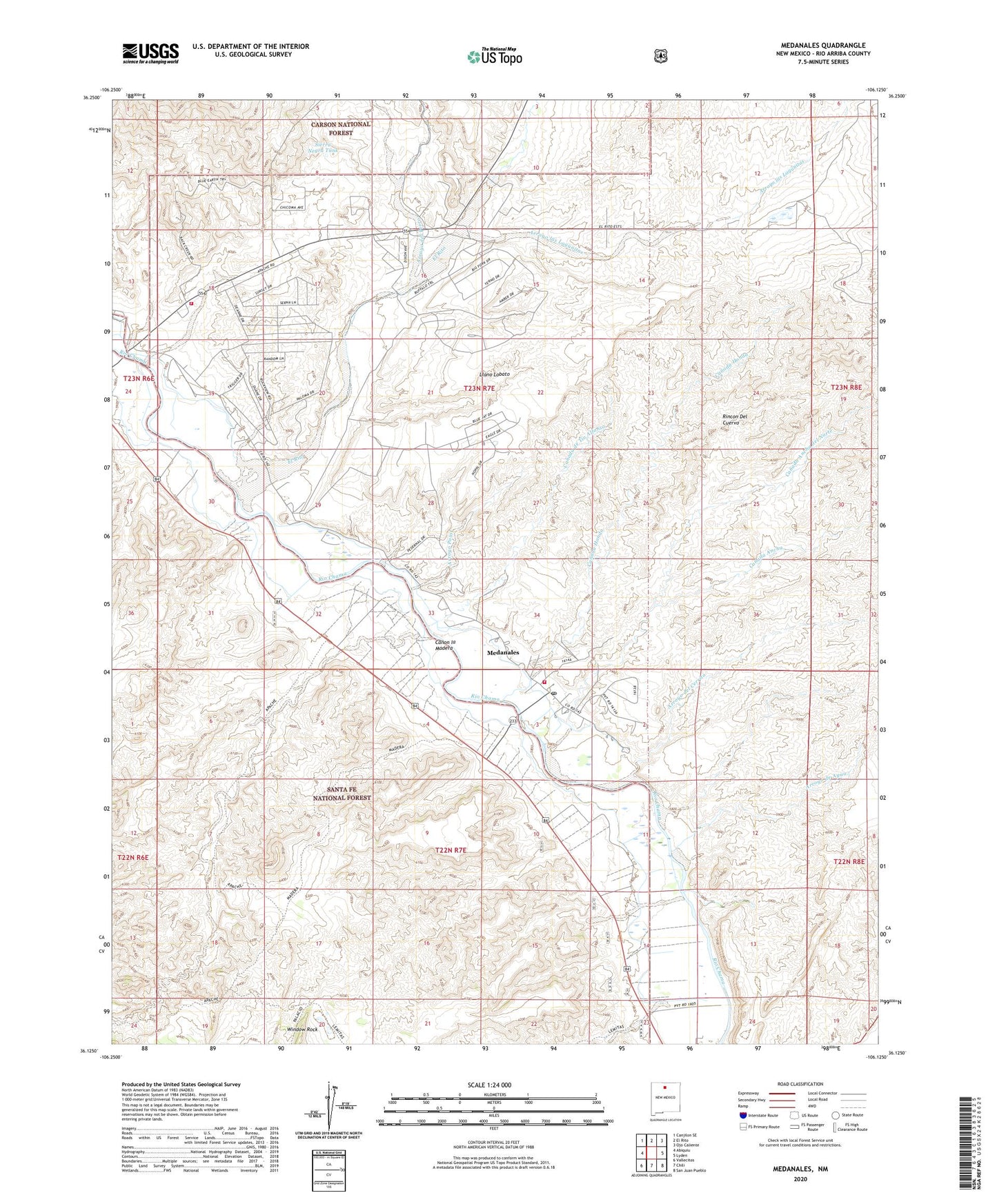
Medanales New Mexico US Topo Map
Couldn't load pickup availability
Also explore the Medanales Forest Service Topo of this same quad for updated USFS data
2023 topographic map quadrangle Medanales in the state of New Mexico. Scale: 1:24000. Based on the newly updated USGS 7.5' US Topo map series, this map is in the following counties: Rio Arriba. The map contains contour data, water features, and other items you are used to seeing on USGS maps, but also has updated roads and other features. This is the next generation of topographic maps. Printed on high-quality waterproof paper with UV fade-resistant inks.
Quads adjacent to this one:
West: Abiquiu
Northwest: Canjilon SE
North: El Rito
Northeast: Ojo Caliente
East: Lyden
Southeast: San Juan Pueblo
South: Chili
Southwest: Vallecitos
This map covers the same area as the classic USGS quad with code o36106b2.
Contains the following named places: Abiquiu Fire Protection District Main Station, Abiquiu Fire Protection District Station 2, Arroyo de Agua, Arroyo de las Lemitas, Arroyo de los Pinavetes, Arroyo del Cerrito, Arroyo del Perro, Arroyo del Perro del oeste, Arroyo del Toro, Arroyo las Lagunitas, Arroyo Ponil, Canada Ancha, Canada Ancha del Norte, Canada de Horno, Canada de las Lemitas, Canada de los Alamos, Canada de Tio Alfonso, Canada Honda, Canon la Madera, El Rito, Llano Lobato, Madera Trail, Medanales, Medanales Census Designated Place, Medanales Post Office, Quarter Circle Ranch, RG-12541 Water Well, RG-15335 Water Well, RG-17400 Water Well, RG-18262 Water Well, RG-19249 Water Well, RG-19392 Water Well, RG-23556 Water Well, RG-28313 Water Well, RG-3300 Water Well, RG-5325 Water Well, Rincon Del Cuervo, Rio Chama Division, San Antonio Church, Sierra Negra Tank, Tierra Azul, Window Rock, Window Rock Trick Tank, ZIP Code: 87548