
MyTopo
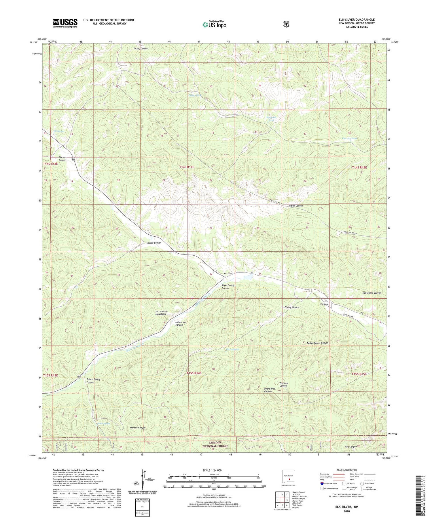
Elk-Silver New Mexico US Topo Map
Couldn't load pickup availability
Also explore the Elk-Silver Forest Service Topo of this same quad for updated USFS data
2023 topographic map quadrangle Elk-Silver in the state of New Mexico. Scale: 1:24000. Based on the newly updated USGS 7.5' US Topo map series, this map is in the following counties: Otero. The map contains contour data, water features, and other items you are used to seeing on USGS maps, but also has updated roads and other features. This is the next generation of topographic maps. Printed on high-quality waterproof paper with UV fade-resistant inks.
Quads adjacent to this one:
West: Firman Canyon
Northwest: Apache Summit
North: Whitetail
Northeast: Pajarita Mountain
East: Turkey Peak
Southeast: Mayhill
South: Bell Canyon
Southwest: Cloudcroft
This map covers the same area as the classic USGS quad with code o33105a5.
Contains the following named places: Camp Geronimo, Charley Tank, Cherry Canyon, Cherry Spring, Cooley Canyon, Cooley Canyon Dam Number 2, Dolan Tank, Dolan Well, Elk- Silver, Elk Springs, Indian Joe Canyon, Mogoosh Tank, Morgan Canyon, Nahtzillee Canyon, Nahtzillee Dam, Poison Spring, Silver Springs, Silver Springs Canyon, Silver Springs Creek, Solon Dam, Turkey Spring Canyon


