MyTopo
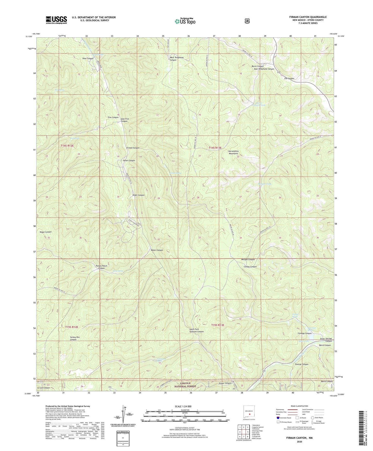
Firman Canyon New Mexico US Topo Map
Couldn't load pickup availability
Also explore the Firman Canyon Forest Service Topo of this same quad for updated USFS data
2023 topographic map quadrangle Firman Canyon in the state of New Mexico. Scale: 1:24000. Based on the newly updated USGS 7.5' US Topo map series, this map is in the following counties: Otero. The map contains contour data, water features, and other items you are used to seeing on USGS maps, but also has updated roads and other features. This is the next generation of topographic maps. Printed on high-quality waterproof paper with UV fade-resistant inks.
Quads adjacent to this one:
West: Domingo Peak
Northwest: Mescalero
North: Apache Summit
Northeast: Whitetail
East: Elk-Silver
Southeast: Bell Canyon
South: Cloudcroft
Southwest: High Rolls
This map covers the same area as the classic USGS quad with code o33105a6.
Contains the following named places: Baird Canyon, Breece Well, Burnt Canyon, Burnt Canyon Tank, Cienega Canyon, Cienega Spring, Deer Flats Spring, East Five Canyon, East Telephone Canyon, Eight Canyon, Fireman Lake, Firman Canyon, Firman Spring, Five Canyon, Five Spring, George Canyon, Head Springs, Headwater Picnic Grounds, Horse Spring, Morgan Tank, Peso Canyon, Peso Spring, Potato Patch Canyon, Red Cabin, Seven Canyon, Shields Dam, Silver Lake, Silver Springs Dam, Turkey Pen Spring, Water Canyon, Zinker Canyon