MyTopo
Bell Canyon New Mexico US Topo Map
Couldn't load pickup availability
Also explore the Bell Canyon Forest Service Topo of this same quad for updated USFS data
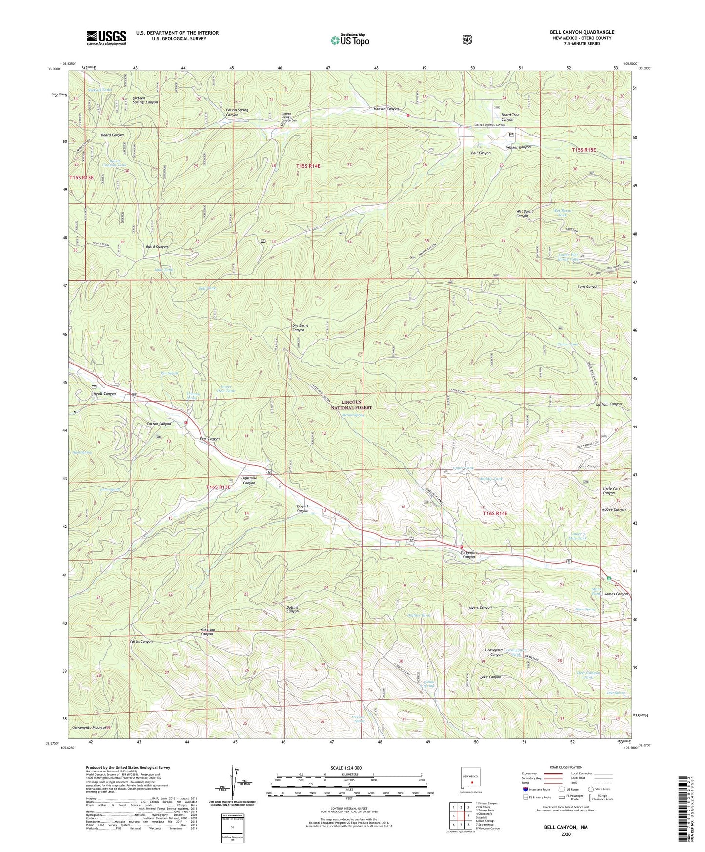
2023 topographic map quadrangle Bell Canyon in the state of New Mexico. Scale: 1:24000. Based on the newly updated USGS 7.5' US Topo map series, this map is in the following counties: Otero. The map contains contour data, water features, and other items you are used to seeing on USGS maps, but also has updated roads and other features. This is the next generation of topographic maps. Printed on high-quality waterproof paper with UV fade-resistant inks.
Quads adjacent to this one:
West: Cloudcroft
Northwest: Firman Canyon
North: Elk-Silver
Northeast: Turkey Peak
East: Mayhill
Southeast: Woodson Canyon
South: Sacramento
Southwest: Bluff Springs
Contains the following named places: Baird Canyon Tank, Beard Canyon, Bell Canyon, Bell Tank, Board Tree Canyon, Chimney Spring, Christadelphian Church, Church Camp, Claim Tank, Coleman Ranch, Cotton Canyon, Cotton Spring, Deer Canyon Tank, Deer Spring, Dollins Spring, Dollins Tank, Eightmile Canyon, Grainery Tank, Graveyard Tank, Hansen Canyon, Hortonville, Hyatt Canyon, Hyatt Spring, James Canyon Campground, James Canyon Volunteer Fire Department Station 2, James Ridge Lookout, Lake Tank, Latham Canyon, Latham Tank, Lower 3 Mile Tank, Lower Dew Tank, Lower Wet Burnt Tank, Mars Tank, Mayhill Volunteer Fire Department Substation 2, McNatt Spring, Mickison Spring, Middle Tank, Myers Spring, Nickols Tank, Nickols Well, Pew Canyon, Pew Spring, Poison Spring Canyon, Sixteen Springs Canyon Cemetery, Sixteen Springs Canyon Volunteer Fire Department, Three L Canyon, Threemile Canyon, Upper Tank, Walker Canyon, Wet Burnt Tank