MyTopo
Leandro Canyon New Mexico US Topo Map
Couldn't load pickup availability
Also explore the Leandro Canyon Forest Service Topo of this same quad for updated USFS data
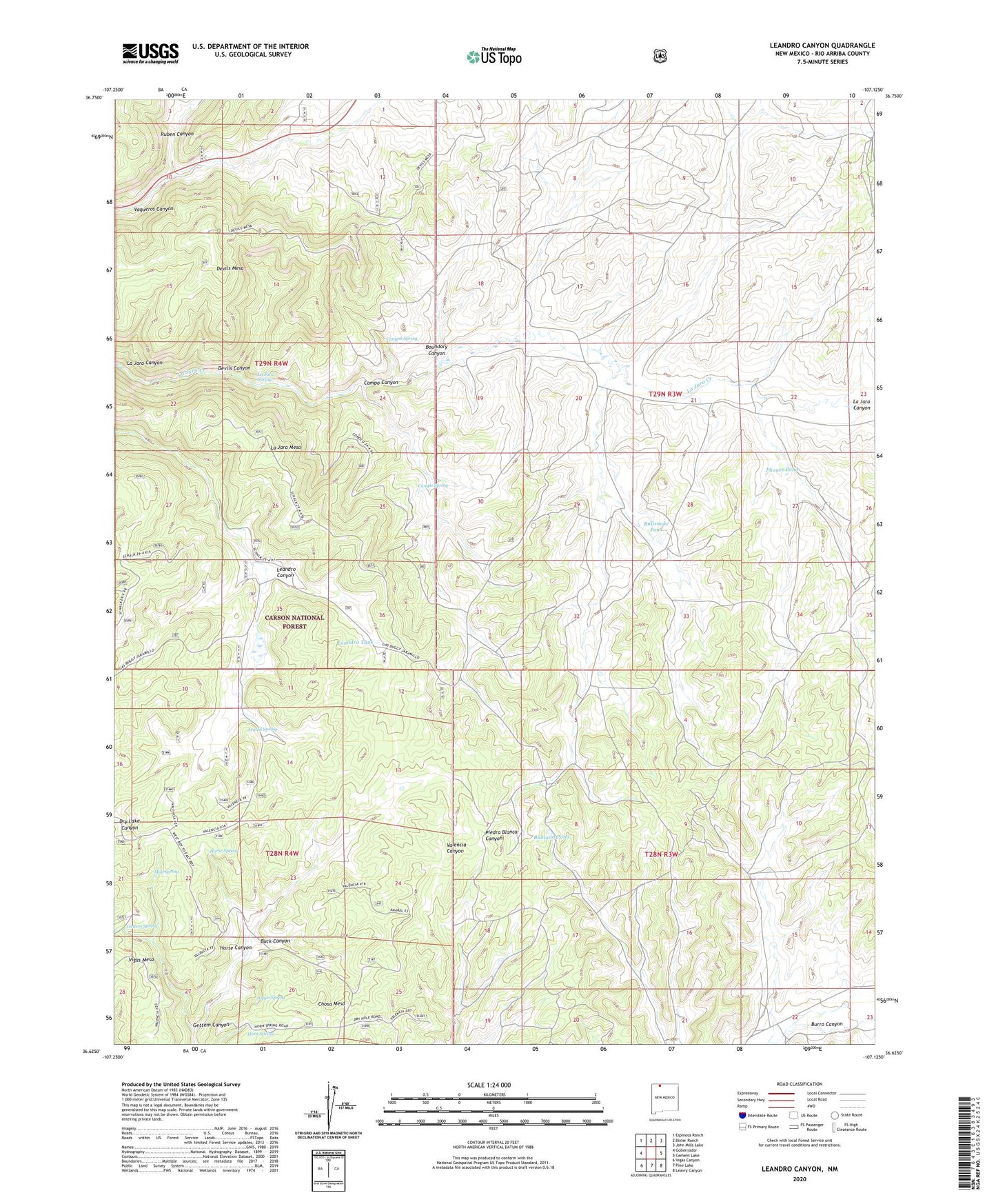
2023 topographic map quadrangle Leandro Canyon in the state of New Mexico. Scale: 1:24000. Based on the newly updated USGS 7.5' US Topo map series, this map is in the following counties: Rio Arriba. The map contains contour data, water features, and other items you are used to seeing on USGS maps, but also has updated roads and other features. This is the next generation of topographic maps. Printed on high-quality waterproof paper with UV fade-resistant inks.
Quads adjacent to this one:
West: Gobernador
Northwest: Espinosa Ranch
North: Bixler Ranch
Northeast: John Mills Lake
East: Cement Lake
Southeast: Leavry Canyon
South: Pine Lake
Southwest: Vigas Canyon
This map covers the same area as the classic USGS quad with code o36107f2.
Contains the following named places: Arnold Spring, Aspen Spring, Badland Pond, Boundary Canyon, Buck Canyon, Bullsnake Pond, Caesar Spring, Campo Canyon, Campo Spring, Canyon Spring, Devils Canyon, GB-1 Water Well, GB-2 Water Well, GB-3 Water Well, Gettem Canyon, Gettem Spring, Gomez Tank, Horn Spring, Horse Canyon, Horse Spring, La Jara Mesa, La Jara Spring, Laguna Seca, Leandro Canyon, Leandro Tank, Mud Spring, Phones Pond, Piedra Tank, Ruben Canyon, Valencia Canyon Tank