MyTopo
Gobernador New Mexico US Topo Map
Couldn't load pickup availability
Also explore the Gobernador Forest Service Topo of this same quad for updated USFS data
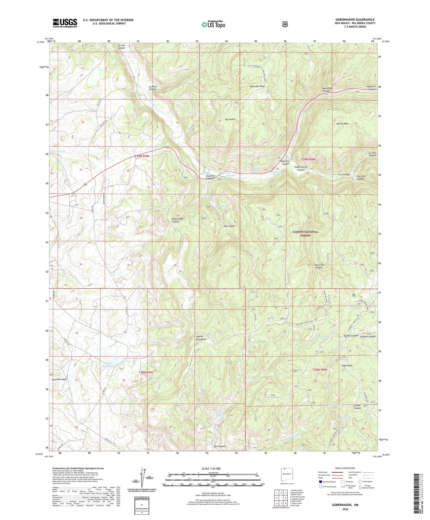
2023 topographic map quadrangle Gobernador in the state of New Mexico. Scale: 1:24000. Based on the newly updated USGS 7.5' US Topo map series, this map is in the following counties: Rio Arriba. The map contains contour data, water features, and other items you are used to seeing on USGS maps, but also has updated roads and other features. This is the next generation of topographic maps. Printed on high-quality waterproof paper with UV fade-resistant inks.
Quads adjacent to this one:
West: Fourmile Canyon
Northwest: Gomez Ranch
North: Espinosa Ranch
Northeast: Bixler Ranch
East: Leandro Canyon
Southeast: Pine Lake
South: Vigas Canyon
Southwest: Santos Peak
This map covers the same area as the classic USGS quad with code o36107f3.
Contains the following named places: Amarante Spring, Arnold Ranch Spring, Bubbling Spring, Burro Spring, Cave Spring, Cedar Spring, Cedar Spring Canyon, Devils Mesa, Devils Mesa Tank, Dry Lake Canyon, Dry Point, Dry Point Tank, Fire Canyon, Gobernador, Gobernador Weather Station, Jog Canyon, La Baca Canyon, Laguna Seca Mesa, Lodge Spring, Martinez Canyon, Martinez Tank, Mestenas Canyon, Munoz Spring, Oso Canyon, Pointed Tank, Pueblita Canyon, Russell Arnold Ranch, Skousen Spring, Timez Spring, Trujillo Reservoir, Vaqueros Canyon, Vigas Mesa, Vigas Spring