MyTopo
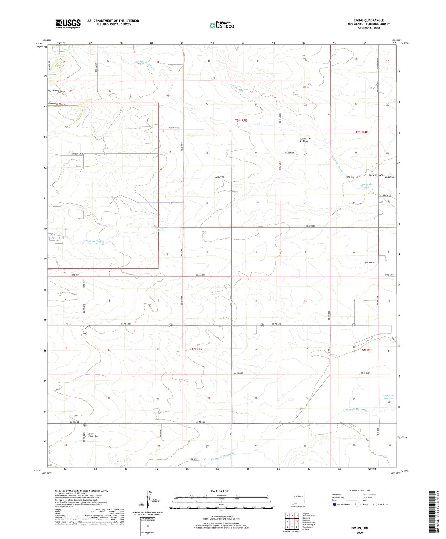
Ewing New Mexico US Topo Map
Couldn't load pickup availability
2020 topographic map quadrangle Ewing in the state of New Mexico. Scale: 1:24000. Based on the newly updated USGS 7.5' US Topo map series, this map is in the following counties: Torrance. The map contains contour data, water features, and other items you are used to seeing on USGS maps, but also has updated roads and other features. This is the next generation of topographic maps. Printed on high-quality waterproof paper with UV fade-resistant inks.
Quads adjacent to this one:
West: Torreon
Northwest: Tajique
North: Milbourn Ranch
Northeast: Estancia
East: Mountainair NE
Southeast: Willard
South: Mountainair
Southwest: Punta de Agua
Contains the following named places: 10020 Water Well, 10021 Water Well, 10026 Water Well, 10030 Water Well, 10061 Water Well, 10198 Water Well, Arroyo de Tajique, Arroyo del Cuervo, Arroyo Miga, Dressler Ranch, Elliott Ranch, Ewing School, Holliday Ranch, Langley Ranch, LK Markel Ranch, Meadows Ranch, Mount Calvary Cemetery, O L Markel Ranch, Reynolds Windmill