MyTopo
Milbourn Ranch New Mexico US Topo Map
Couldn't load pickup availability
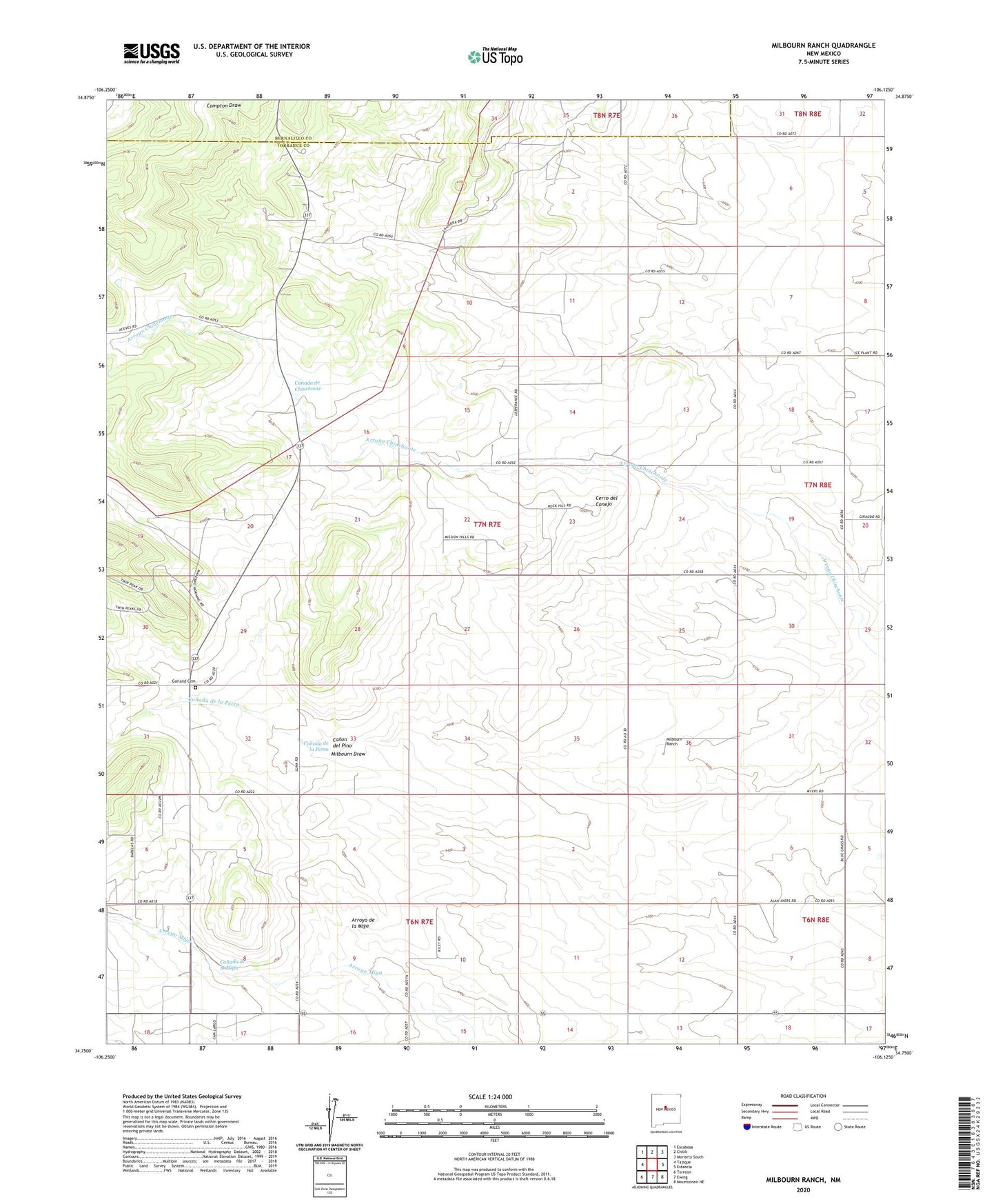
2023 topographic map quadrangle Milbourn Ranch in the state of New Mexico. Scale: 1:24000. Based on the newly updated USGS 7.5' US Topo map series, this map is in the following counties: Torrance, Bernalillo. The map contains contour data, water features, and other items you are used to seeing on USGS maps, but also has updated roads and other features. This is the next generation of topographic maps. Printed on high-quality waterproof paper with UV fade-resistant inks.
Quads adjacent to this one:
West: Tajique
Northwest: Escabosa
North: Chilili
Northeast: Moriarty South
East: Estancia
Southeast: Mountainair NE
South: Ewing
Southwest: Torreon
This map covers the same area as the classic USGS quad with code o34106g2.
Contains the following named places: Arroyo de la Miga, Canada de Chinchonte, Canada de la Miga, Canada de la Perra, Canon del Pino, Cedar Grove Church, Cerro del Conejo, Chief 1-A Pace Mine, Chief I Pace, Drice I Garland, Esatancia 2 Dehart, Estancia 1 Kellogg Mine, Estancia 1 Kutchin, Estancia 1 Roland, Estancia 3 Dehart, Estancia 4 Dehart, Estancia 5 Dehart, Garland Cemetery, Goodner Ranch, Lee I Milburn, Meyers 1 Milburn, Meyers 1 Smith, Milbourn Ranch, Tijeras Ranch, Windmill Water Well