MyTopo
Fence Lake New Mexico US Topo Map
Couldn't load pickup availability
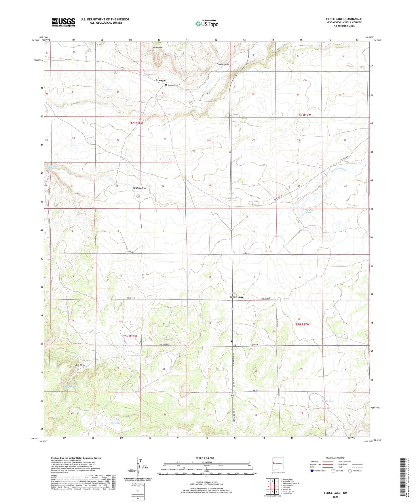
2020 topographic map quadrangle Fence Lake in the state of New Mexico. Scale: 1:24000. Based on the newly updated USGS 7.5' US Topo map series, this map is in the following counties: Cibola. The map contains contour data, water features, and other items you are used to seeing on USGS maps, but also has updated roads and other features. This is the next generation of topographic maps. Printed on high-quality waterproof paper with UV fade-resistant inks.
Quads adjacent to this one:
West: Rincon Hondo
Northwest: Atarque Lake
North: Mesita De Yeso
Northeast: Shoemaker Canyon SE
East: The Dyke
Southeast: Cerro Prieto
South: Fence Lake SW
Southwest: Moreno Hill
Contains the following named places: Atarque, Atarque Cemetery, Atarque Post Office, Cabin Spring, Canon Ancho, Chaparral Lake, Dog Lake, East Malpais Windmill, Fence Lake, Fence Lake Census Designated Place, Fence Lake Division, Fence Lake Post Office, Fence Lake Volunteer Fire Department, Fence Lake Weather Station, Jacobine Water Well, Lorenzo Arroyo, Los Alamos Springs, Los Pilares, Red Cliffs